Florestópolis night lights from space
Night Light of Florestópolis (Paraná) from space (Brazil) Src. Average luminocity for 10x10km area is 8.5833% and for 50x50km: 2.3491%.
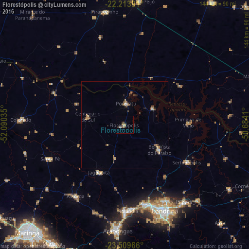
Analysis of Florestópolis night lights 2016
Square area 10x10 km:
 1.39%
1.39%90-99
0.99%80-89
0.4%70-79
0.79%60-69
2.78%50-59
0.4%40-49
2.38%30-39
0.99%20-29
0.99%10-19
0%0-9
88.89%Square area 50x50 km:
0.24%90-99
0.17%80-89
0.26%70-79
0.45%60-69
0.38%50-59
0.33%40-49
0.51%30-39
0.34%20-29
0.31%10-19
0.09%0-9
96.92%Clear (daylight) street map image can be seen on geolist.org.
Map coordinates:
22° 12' 50.1" South, 52° 5' 25.3" West
22° 51' 48" South, 51° 23' 14" West
23° 30' 34.8" South, 50° 41' 2.8" West
Some cities around Florestópolis sort by population:
• Londrina
54.7 km =34 mi,  155°
155°
• Cambé
47.2 km =29.3 mi,  166°
166°
• Rolândia
49.7 km =30.9 mi,  177°
177°
• Astorga
50 km =31.1 mi,  214°
214°
• Bela Vista do Paraíso
25 km =15.5 mi,  126°
126°
• Sertanópolis
42 km =26.1 mi,  121°
121°
• Porecatu
12 km =7.5 mi,  3°
3°
• Centenário do Sul
21.8 km =13.5 mi,  282°
282°
3463246 (p: 13,250)
Sources (retrieved 2019-11-25):
» Earth at Night: Flat Maps 2012, 2016