Estância night lights from space
Night Light of Estância (Sergipe) from space (Brazil) Src. Average luminocity for 10x10km area is 39.7056% and for 50x50km: 7.7479%.
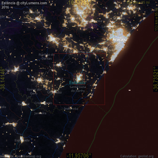
Analysis of Estância night lights 2016
Square area 10x10 km:
 6.06%
6.06%90-99
10.39%80-89
2.38%70-79
1.52%60-69
8.66%50-59
7.36%40-49
4.33%30-39
4.76%20-29
2.81%10-19
41.99%0-9
9.74%Square area 50x50 km:
0.47%90-99
0.98%80-89
0.42%70-79
0.45%60-69
1.12%50-59
1.95%40-49
1.21%30-39
1.48%20-29
1.61%10-19
5.73%0-9
84.57%Clear (daylight) street map image can be seen on geolist.org.
Map coordinates:
10° 34' 40.6" South, 38° 8' 29.3" West
11° 16' 6" South, 37° 26' 18" West
11° 57' 25.4" South, 36° 44' 6.8" West
Some cities around Estância sort by population:
• Aracaju
56.4 km =35 mi,  45°
45°
• São Cristóvão
37.9 km =23.5 mi,  41°
41°
• Lagarto
45.4 km =28.2 mi,  329°
329°
• Itabaianinha
38.4 km =23.9 mi,  269°
269°
• Boquim
24 km =14.9 mi,  304°
304°
• Umbaúba
27.1 km =16.8 mi,  241°
241°
• Cristinápolis
41.5 km =25.8 mi, 236°
• Salgado
26.6 km =16.5 mi,  351°
351°
3463900 (p: 55,654)
Sources (retrieved 2019-11-25):
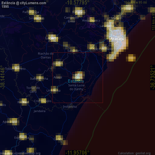
» NASA, Earths city lights 1995
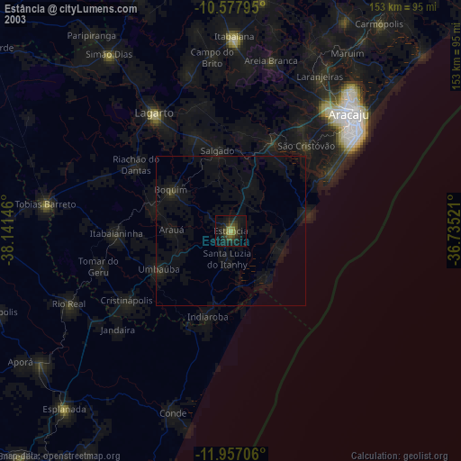
» NASA city lights 2003
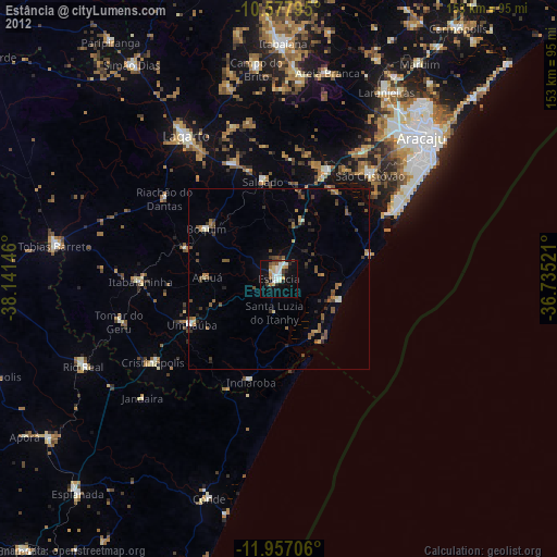
» Earth at Night: Flat Maps 2012, 2016