São Cristóvão night lights from space
Night Light of São Cristóvão (Sergipe) from space (Brazil) Src. Average luminocity for 10x10km area is 37.1234% and for 50x50km: 27.3292%.
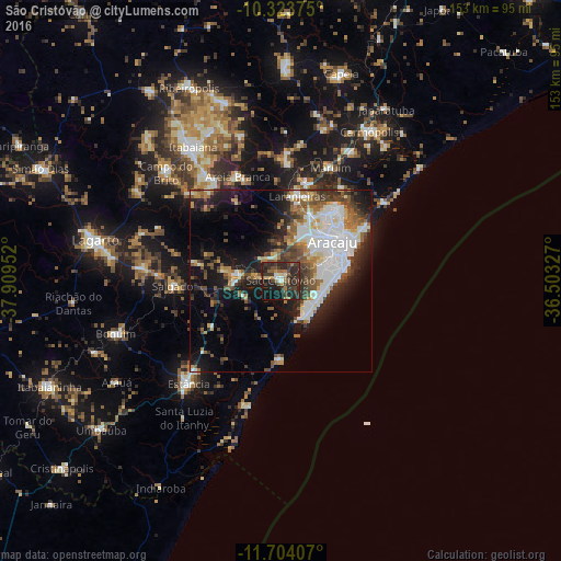
Analysis of São Cristóvão night lights 2016
Square area 10x10 km:
 2.16%
2.16%90-99
3.9%80-89
3.25%70-79
1.52%60-69
7.79%50-59
5.19%40-49
7.14%30-39
19.48%20-29
25.97%10-19
21.86%0-9
1.73%Square area 50x50 km:
5.78%90-99
5.99%80-89
2.06%70-79
2.01%60-69
3.36%50-59
4.24%40-49
4.12%30-39
4.4%20-29
6.91%10-19
13.64%0-9
47.49%Clear (daylight) street map image can be seen on geolist.org.
Map coordinates:
10° 19' 25.5" South, 37° 54' 34.3" West
11° 0' 53" South, 37° 12' 23" West
11° 42' 14.7" South, 36° 30' 11.8" West
Some cities around São Cristóvão sort by population:
• Aracaju
18.7 km =11.6 mi,  51°
51°
• Nossa Senhora do Socorro
19.8 km =12.3 mi,  26°
26°
• Barra dos Coqueiros
21.8 km =13.5 mi,  57°
57°
• Laranjeiras
23.5 km =14.6 mi,  9°
9°
• Maruim
33.7 km =20.9 mi,  23°
23°
• Santo Amaro das Brotas
30.1 km =18.7 mi, 33°
• Areia Branca
30.9 km =19.2 mi,  337°
337°
• Salgado
29.4 km =18.3 mi,  266°
266°
3449310 (p: 71,539)
Sources (retrieved 2019-11-25):
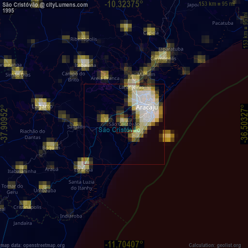
» NASA, Earths city lights 1995
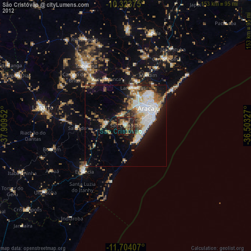
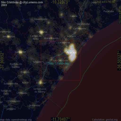
» NASA city lights 2003
» Earth at Night: Flat Maps 2012, 2016