Corbélia night lights from space
Night Light of Corbélia (Paraná) from space (Brazil) Src. Average luminocity for 10x10km area is 8.6269% and for 50x50km: 7.1088%.
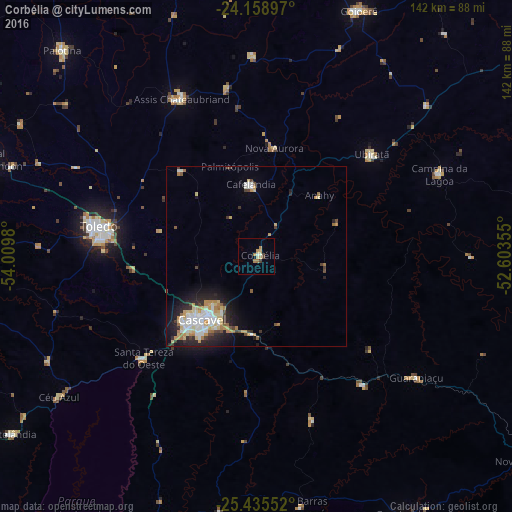
Analysis of Corbélia night lights 2016
Square area 10x10 km:
 0.38%
0.38%90-99
1.14%80-89
2.27%70-79
1.7%60-69
2.08%50-59
0%40-49
1.33%30-39
0.95%20-29
0%10-19
0.19%0-9
89.96%Square area 50x50 km:
1.35%90-99
1.23%80-89
1.17%70-79
1.02%60-69
0.91%50-59
0.3%40-49
0.79%30-39
0.67%20-29
1.99%10-19
3.44%0-9
87.11%Clear (daylight) street map image can be seen on geolist.org.
Map coordinates:
24° 9' 32.3" South, 54° 0' 35.3" West
24° 47' 56" South, 53° 18' 24" West
25° 26' 7.9" South, 52° 36' 12.8" West
Some cities around Corbélia sort by population:
• Cascavel
23 km =14.3 mi,  220°
220°
• Toledo
45.1 km =28 mi,  282°
282°
• Marechal Cândido Rondon
80.4 km =50 mi,  289°
289°
• Palotina
78.7 km =48.9 mi,  316°
316°
• Matelândia
85.1 km =52.9 mi,  234°
234°
• Alto Piquiri
86.8 km =53.9 mi,  351°
351°
• Moreira Sales
87.3 km =54.2 mi,  20°
20°
• Guaraniaçu
54.7 km =34 mi,  127°
127°
3465536 (p: 12,725)
Sources (retrieved 2019-11-25):
» Earth at Night: Flat Maps 2012, 2016