Santo Amaro night lights from space
Night Light of Santo Amaro (Bahia) from space (Brazil) Src. Average luminocity for 10x10km area is 22.1255% and for 50x50km: 18.803%.
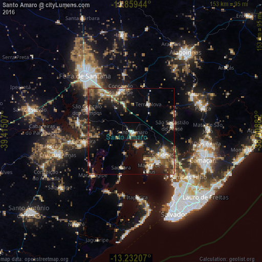
Analysis of Santo Amaro night lights 2016
Square area 10x10 km:
 2.6%
2.6%90-99
5.63%80-89
2.16%70-79
1.95%60-69
3.68%50-59
1.3%40-49
0%30-39
1.08%20-29
2.38%10-19
30.95%0-9
48.27%Square area 50x50 km:
0.83%90-99
3.64%80-89
1.96%70-79
1.38%60-69
2.62%50-59
3.99%40-49
3.83%30-39
3.46%20-29
6.27%10-19
12.82%0-9
59.19%Clear (daylight) street map image can be seen on geolist.org.
Map coordinates:
11° 51' 34" South, 39° 24' 54.3" West
12° 32' 48" South, 38° 42' 43" West
13° 13' 55.5" South, 38° 0' 31.8" West
Some cities around Santo Amaro sort by population:
• São Sebastião do Passé
23.8 km =14.8 mi,  80°
80°
• São Francisco do Conde
9.6 km =6 mi,  158°
158°
• Conceição do Jacuípe
26.3 km =16.3 mi,  346°
346°
• Cachoeira
28.2 km =17.5 mi,  257°
257°
• Conceição da Feira
31.4 km =19.5 mi,  278°
278°
• Saubara
22.1 km =13.7 mi,  196°
196°
• Madre de Deus
23.7 km =14.7 mi, 155°
• São Gonçalo dos Campos
30.4 km =18.9 mi,  294°
294°
3449720 (p: 46,748)
Sources (retrieved 2019-11-25):
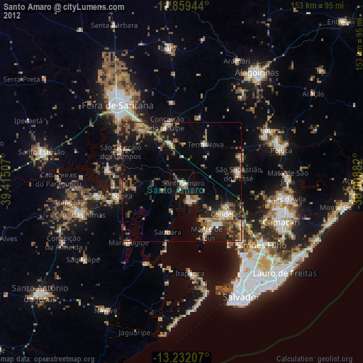
» Earth at Night: Flat Maps 2012, 2016