Clevelândia night lights from space
Night Light of Clevelândia (Paraná) from space (Brazil) Src. Average luminocity for 10x10km area is 0.0625% and for 50x50km: 3.2384%.
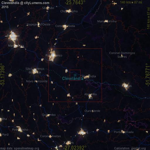
Analysis of Clevelândia night lights 2016
Square area 10x10 km:
 0%
0%90-99
0%80-89
0%70-79
0%60-69
0%50-59
0%40-49
0%30-39
0%20-29
0%10-19
0%0-9
100%Square area 50x50 km:
0.35%90-99
0.34%80-89
0.53%70-79
0.56%60-69
0.77%50-59
0.42%40-49
0.19%30-39
0.41%20-29
0.49%10-19
2%0-9
93.94%Clear (daylight) street map image can be seen on geolist.org.
Map coordinates:
25° 45' 51.5" South, 53° 10' 26.3" West
26° 23' 45" South, 52° 28' 15" West
27° 1' 26.1" South, 51° 46' 3.8" West
Some cities around Clevelândia sort by population:
• Chapecó
79.3 km =49.3 mi,  190°
190°
• Pato Branco
27.2 km =16.9 mi,  313°
313°
• Francisco Beltrão
68 km =42.3 mi,  300°
300°
• Palmas
48.8 km =30.3 mi,  101°
101°
• Xanxerê
53.9 km =33.5 mi,  172°
172°
• Coronel Vivida
47.3 km =29.4 mi,  348°
348°
• São Lourenço do Oeste
38.1 km =23.7 mi,  276°
276°
• Chopinzinho
60.3 km =37.5 mi,  355°
355°
3466046 (p: 14,701)
Sources (retrieved 2019-11-25):
» Earth at Night: Flat Maps 2012, 2016