Cipó night lights from space
Night Light of Cipó (Bahia) from space (Brazil) Src. Average luminocity for 10x10km area is 14.7251% and for 50x50km: 1.6968%.
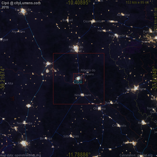
Analysis of Cipó night lights 2016
Square area 10x10 km:
 2.16%
2.16%90-99
3.9%80-89
0.87%70-79
0%60-69
1.3%50-59
2.6%40-49
2.38%30-39
1.73%20-29
3.25%10-19
0.22%0-9
81.6%Square area 50x50 km:
0.18%90-99
0.26%80-89
0.07%70-79
0.05%60-69
0.16%50-59
0.5%40-49
0.24%30-39
0.37%20-29
0.48%10-19
0.09%0-9
97.59%Clear (daylight) street map image can be seen on geolist.org.
Map coordinates:
10° 24' 32.2" South, 39° 13' 0.3" West
11° 5' 59" South, 38° 30' 49" West
11° 47' 19.9" South, 37° 48' 37.8" West
Some cities around Cipó sort by population:
• Tucano
34.1 km =21.2 mi,  297°
297°
• Tobias Barreto
57 km =35.4 mi,  99°
99°
• Ribeira do Pombal
29.6 km =18.4 mi,  355°
355°
• Cícero Dantas
57.4 km =35.7 mi,  14°
14°
• Araci
55.8 km =34.7 mi,  242°
242°
• Olindina
35.6 km =22.1 mi,  146°
146°
• Poço Verde
56.5 km =35.1 mi,  39°
39°
• Nova Soure
15.2 km =9.4 mi,  167°
167°
3466134 (p: 10,821)
Sources (retrieved 2019-11-25):
» Earth at Night: Flat Maps 2012, 2016