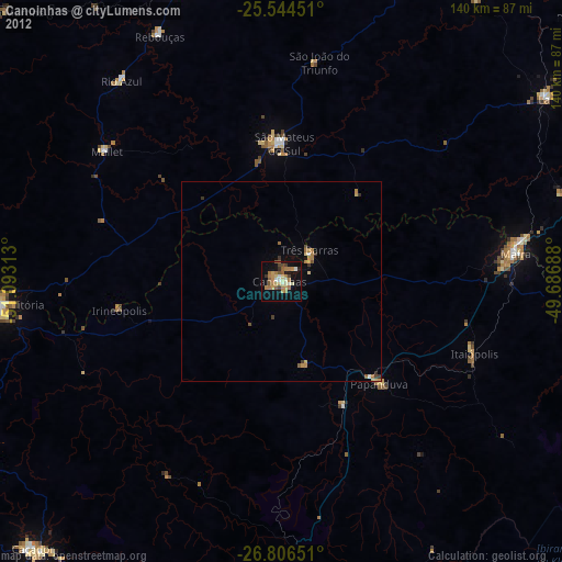
Canoinhas night lights from space
Night Light of Canoinhas (Santa Catarina) from space (Brazil) Src. Average luminocity for 10x10km area is 29.5913% and for 50x50km: 1.9395%.
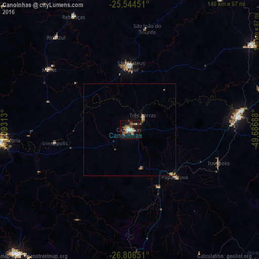
Analysis of Canoinhas night lights 2016
Square area 10x10 km:
 3.37%
3.37%90-99
4.76%80-89
2.18%70-79
1.39%60-69
3.77%50-59
10.91%40-49
5.36%30-39
4.17%20-29
1.79%10-19
33.33%0-9
28.97%Square area 50x50 km:
0.15%90-99
0.2%80-89
0.16%70-79
0.24%60-69
0.26%50-59
0.65%40-49
0.26%30-39
0.28%20-29
0.13%10-19
1.42%0-9
96.24%Clear (daylight) street map image can be seen on geolist.org.
Map coordinates:
25° 32' 40.2" South, 51° 5' 35.3" West
26° 10' 38" South, 50° 23' 24" West
26° 48' 23.4" South, 49° 41' 12.8" West
Some cities around Canoinhas sort by population:
• União da Vitória
69.7 km =43.3 mi,  265°
265°
• Irati
83.2 km =51.7 mi,  341°
341°
• Mafra
58.8 km =36.5 mi,  82°
82°
• Porto União
69 km =42.9 mi,  264°
264°
• Lapa
81.2 km =50.5 mi,  56°
56°
• São Mateus do Sul
33.7 km =20.9 mi,  1°
1°
• Rio Negro
59.7 km =37.1 mi, 82°
• Três Barras
10.4 km =6.5 mi,  40°
40°
3467452 (p: 38,862)
Sources (retrieved 2019-11-25):
» Earth at Night: Flat Maps 2012, 2016