Cananéia night lights from space
Night Light of Cananéia (São Paulo) from space (Brazil) Src. Average luminocity for 10x10km area is 9.1875% and for 50x50km: 0.5465%.
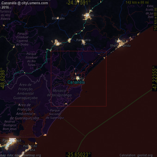
Analysis of Cananéia night lights 2016
Square area 10x10 km:
 0.57%
0.57%90-99
0.38%80-89
2.65%70-79
2.65%60-69
1.33%50-59
1.52%40-49
0.76%30-39
0%20-29
0.38%10-19
0.76%0-9
89.02%Square area 50x50 km:
0.02%90-99
0.02%80-89
0.13%70-79
0.14%60-69
0.06%50-59
0.12%40-49
0.11%30-39
0.04%20-29
0.07%10-19
0.03%0-9
99.26%Clear (daylight) street map image can be seen on geolist.org.
Map coordinates:
24° 22' 33.3" South, 48° 37' 47.3" West
25° 0' 53" South, 47° 55' 36" West
25° 39' 0.8" South, 47° 13' 24.8" West
Some cities around Cananéia sort by population:
• Paranaguá
82.1 km =51 mi,  227°
227°
• Registro
59.2 km =36.8 mi,  8°
8°
• Cajati
36.8 km =22.9 mi,  327°
327°
• Iguape
50.7 km =31.5 mi,  47°
47°
• Antonina
91.4 km =56.8 mi,  239°
239°
• Juquiá
82.6 km =51.3 mi,  20°
20°
• Pariquera Açu
33.6 km =20.9 mi, 7°
• Jacupiranga
36.6 km =22.7 mi,  347°
347°
3467609 (p: 13,785)
Sources (retrieved 2019-11-25):
» Earth at Night: Flat Maps 2012, 2016