Cabo night lights from space
Night Light of Cabo (Pernambuco) from space (Brazil) Src. Average luminocity for 10x10km area is 66.6405% and for 50x50km: 28.9051%.
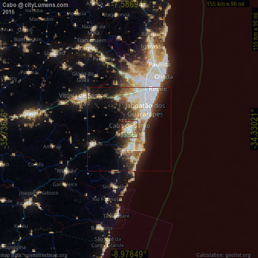
Analysis of Cabo night lights 2016
Square area 10x10 km:
 5.99%
5.99%90-99
13.64%80-89
15.5%70-79
8.88%60-69
18.18%50-59
12.4%40-49
10.12%30-39
8.68%20-29
5.99%10-19
0.62%0-9
0%Square area 50x50 km:
5.29%90-99
5.66%80-89
4.99%70-79
2.31%60-69
3.75%50-59
5.3%40-49
3.32%30-39
3.77%20-29
6.36%10-19
11.32%0-9
47.91%Clear (daylight) street map image can be seen on geolist.org.
Map coordinates:
7° 35' 13" South, 35° 44' 11.3" West
8° 16' 60" South, 35° 1' 60" West
8° 58' 42.6" South, 34° 19' 48.8" West
Some cities around Cabo sort by population:
• Recife
30.5 km =19 mi,  33°
33°
• Jaboatão
12 km =7.5 mi,  17°
17°
• Jaboatão dos Guararapes
19.1 km =11.9 mi,  6°
6°
• Vitória de Santo Antão
33.8 km =21 mi,  302°
302°
• São Lourenço da Mata
31.3 km =19.4 mi,  3°
3°
• Ipojuca
13.3 km =8.3 mi,  194°
194°
• Escada
22.6 km =14 mi,  248°
248°
• Moreno
19.4 km =12.1 mi,  340°
340°
3404545 (p: 143,105)
Sources (retrieved 2019-11-25):
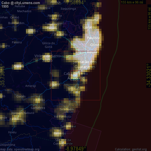
» NASA, Earths city lights 1995
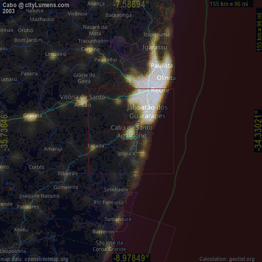
» NASA city lights 2003
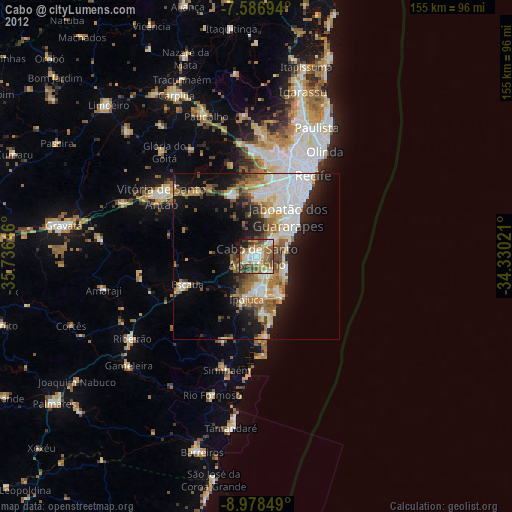
» Earth at Night: Flat Maps 2012, 2016