Jaboatão night lights from space
Night Light of Jaboatão (Pernambuco) from space (Brazil) Src. Average luminocity for 10x10km area is 66.2913% and for 50x50km: 36.5074%.
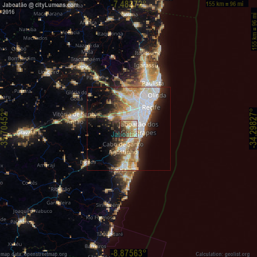
Analysis of Jaboatão night lights 2016
Square area 10x10 km:
 9.3%
9.3%90-99
11.16%80-89
19.01%70-79
8.47%60-69
11.16%50-59
12.19%40-49
9.3%30-39
7.02%20-29
11.78%10-19
0.62%0-9
0%Square area 50x50 km:
8.71%90-99
8.16%80-89
6.41%70-79
2.91%60-69
4.23%50-59
4.74%40-49
3.75%30-39
3.87%20-29
6.62%10-19
10.24%0-9
40.35%Clear (daylight) street map image can be seen on geolist.org.
Map coordinates:
7° 29' 1.4" South, 35° 42' 16.3" West
8° 10' 49" South, 35° 0' 5" West
8° 52' 32.3" South, 34° 17' 53.8" West
Some cities around Jaboatão sort by population:
• Recife
19.3 km =12 mi,  43°
43°
• Olinda
24.9 km =15.5 mi, 40°
• Paulista
30.1 km =18.7 mi,  27°
27°
• Cabo
12 km =7.5 mi,  197°
197°
• São Lourenço da Mata
19.9 km =12.4 mi,  354°
354°
• Ipojuca
25.3 km =15.7 mi, 195°
• Escada
31.5 km =19.6 mi,  230°
230°
• Moreno
12.1 km =7.5 mi,  304°
304°
3397838 (p: 702,621)
Sources (retrieved 2019-11-25):
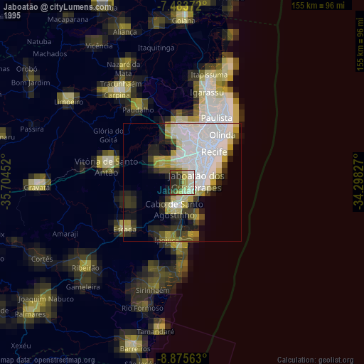
» NASA, Earths city lights 1995
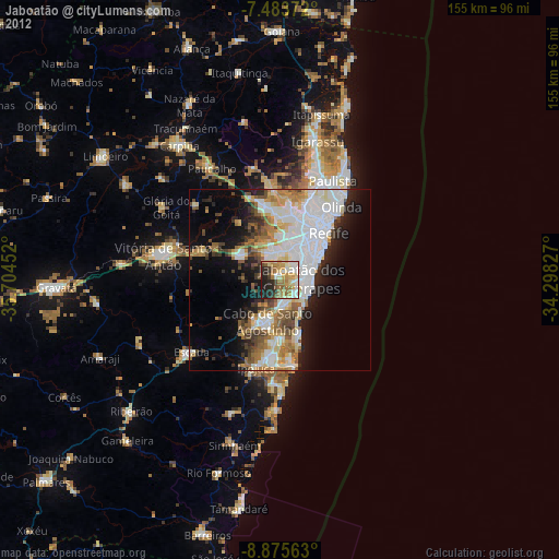
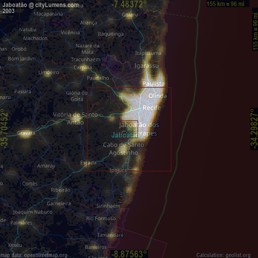
» NASA city lights 2003
» Earth at Night: Flat Maps 2012, 2016