Jaboatão dos Guararapes night lights from space
Night Light of Jaboatão dos Guararapes (Pernambuco) from space (Brazil) Src. Average luminocity for 10x10km area is 83.5599% and for 50x50km: 39.7385%.
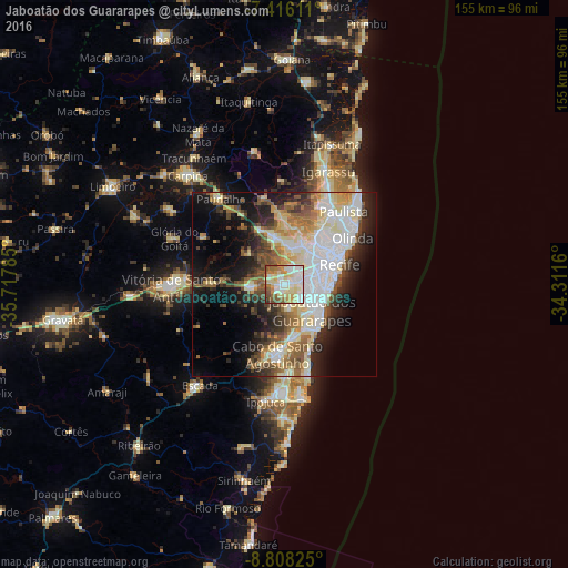
Analysis of Jaboatão dos Guararapes night lights 2016
Square area 10x10 km:
 20.45%
90-99
26.24%80-89
20.87%70-79
9.5%60-69
7.23%50-59
9.92%40-49
4.75%30-39
0.62%20-29
0.41%10-19
0%0-9
0%Square area 50x50 km:
9.25%90-99
8.62%80-89
6.75%70-79
3.15%60-69
4.88%50-59
5.45%40-49
4.43%30-39
4.32%20-29
7.37%10-19
12.83%0-9
32.95%Clear (daylight) street map image can be seen on geolist.org.
Map coordinates:
7° 24' 58" South, 35° 43' 4.3" West
8° 6' 46" South, 35° 0' 53" West
8° 48' 29.7" South, 34° 18' 41.8" West
Some cities around Jaboatão dos Guararapes sort by population:
• Recife
16.1 km =10 mi,  66°
66°
• Olinda
21 km =13 mi,  56°
56°
• Paulista
24.7 km =15.3 mi,  39°
39°
• Cabo
19.1 km =11.9 mi,  186°
186°
• Vitória de Santo Antão
30.5 km =19 mi,  268°
268°
• São Lourenço da Mata
12.3 km =7.6 mi,  358°
358°
• Abreu e Lima
25.5 km =15.8 mi,  28°
28°
• Moreno
8.6 km =5.3 mi, 265°
6317344 (p: 630,008)
Sources (retrieved 2019-11-25):
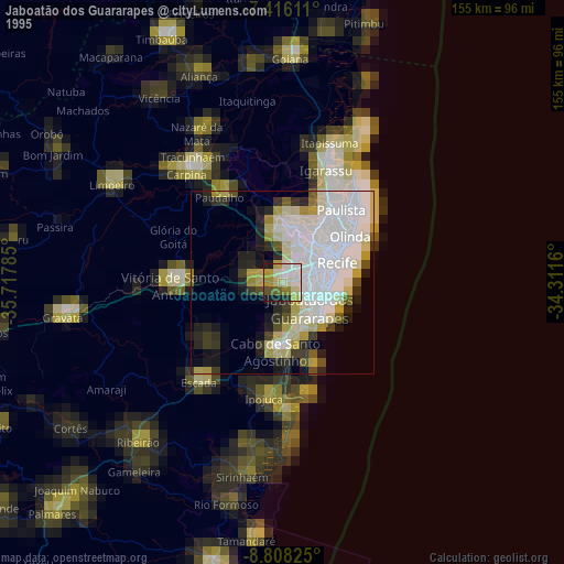
» NASA, Earths city lights 1995
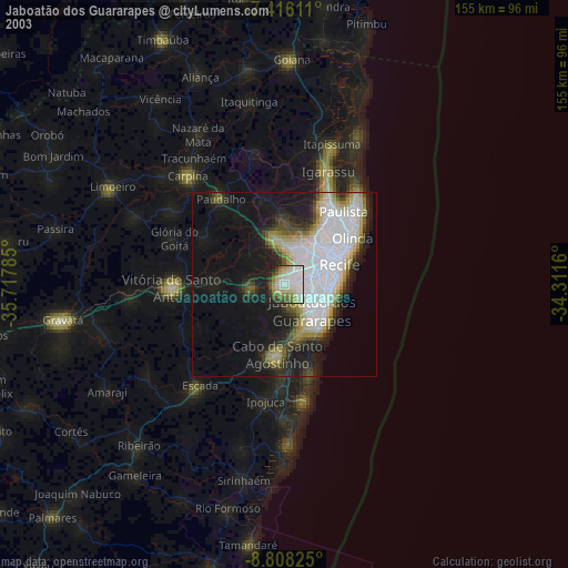
» NASA city lights 2003
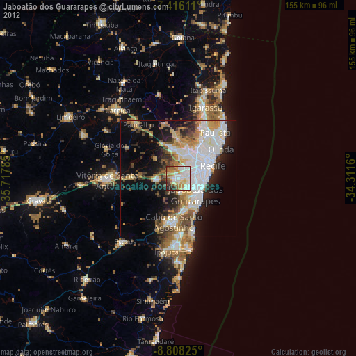
» Earth at Night: Flat Maps 2012, 2016