Bragança Paulista night lights from space
Night Light of Bragança Paulista (São Paulo) from space (Brazil) Src. Average luminocity for 10x10km area is 61.6825% and for 50x50km: 21.1675%.
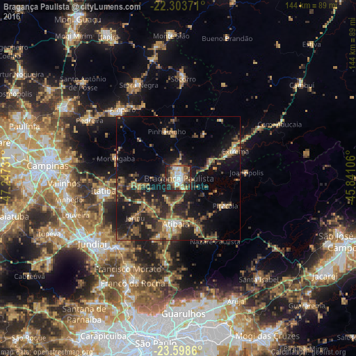
Analysis of Bragança Paulista night lights 2016
Square area 10x10 km:
 10.32%
90-99
13.89%80-89
11.9%70-79
8.13%60-69
6.15%50-59
10.12%40-49
8.53%30-39
12.9%20-29
14.68%10-19
3.37%0-9
0%Square area 50x50 km:
0.96%90-99
1.59%80-89
2.37%70-79
3.43%60-69
3.6%50-59
4.87%40-49
3.69%30-39
4.66%20-29
8.89%10-19
16.53%0-9
49.42%Clear (daylight) street map image can be seen on geolist.org.
Map coordinates:
22° 18' 13.4" South, 47° 14' 50.3" West
22° 57' 9.7" South, 46° 32' 39" West
23° 35' 55" South, 45° 50' 27.8" West
Some cities around Bragança Paulista sort by population:
• Atibaia
18.3 km =11.4 mi,  181°
181°
• Itatiba
30.7 km =19.1 mi,  258°
258°
• Amparo
35.9 km =22.3 mi,  321°
321°
• Piracaia
22.1 km =13.7 mi,  120°
120°
• Jarinu
25.1 km =15.6 mi,  228°
228°
• Extrema
25.6 km =15.9 mi,  64°
64°
• Bom Jesus dos Perdões
21.8 km =13.5 mi,  158°
158°
• Joanópolis
27.6 km =17.1 mi,  84°
84°
3469092 (p: 125,096)
Sources (retrieved 2019-11-25):
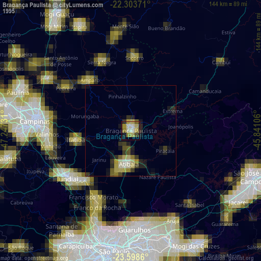
» NASA, Earths city lights 1995
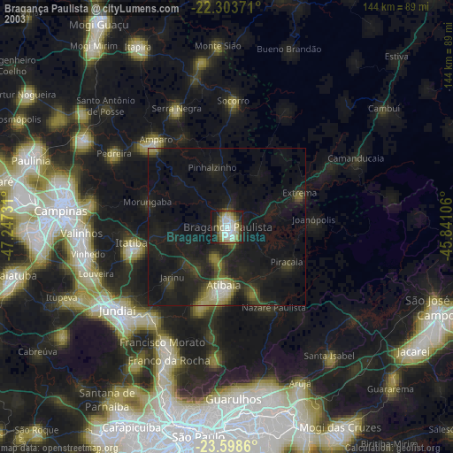
» NASA city lights 2003
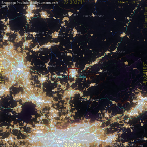
» Earth at Night: Flat Maps 2012, 2016