Barro night lights from space
Night Light of Barro (Ceará) from space (Brazil) Src. Average luminocity for 10x10km area is 0.7835% and for 50x50km: 1.7905%.
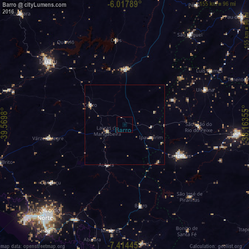
Analysis of Barro night lights 2016
Square area 10x10 km:
 0%
0%90-99
0%80-89
0.87%70-79
0%60-69
0%50-59
0%40-49
0%30-39
0%20-29
0%10-19
0%0-9
99.13%Square area 50x50 km:
0.13%90-99
0.22%80-89
0.34%70-79
0.17%60-69
0.32%50-59
0.49%40-49
0.15%30-39
0.22%20-29
0.24%10-19
0.13%0-9
97.59%Clear (daylight) street map image can be seen on geolist.org.
Map coordinates:
6° 1' 4.4" South, 39° 34' 11.3" West
6° 43' 0" South, 38° 52' 0" West
7° 24' 52" South, 38° 9' 48.8" West
Some cities around Barro sort by population:
• Cajazeiras
39.4 km =24.5 mi,  119°
119°
• Icó
35.1 km =21.8 mi,  0°
0°
• Lavras da Mangabeira
11.5 km =7.1 mi,  249°
249°
• Orós
52.8 km =32.8 mi,  354°
354°
• Cedro
24.8 km =15.4 mi,  299°
299°
• Caririaçu
58.6 km =36.4 mi,  231°
231°
• Aurora
27.5 km =17.1 mi,  203°
203°
• Uiraúna
54.8 km =34.1 mi,  66°
66°
3406088 (p: 11,519)
Sources (retrieved 2019-11-25):
» Earth at Night: Flat Maps 2012, 2016