Cajuru night lights from space
Night Light of Cajuru (São Paulo) from space (Brazil) Src. Average luminocity for 10x10km area is 13.6553% and for 50x50km: 1.6802%.
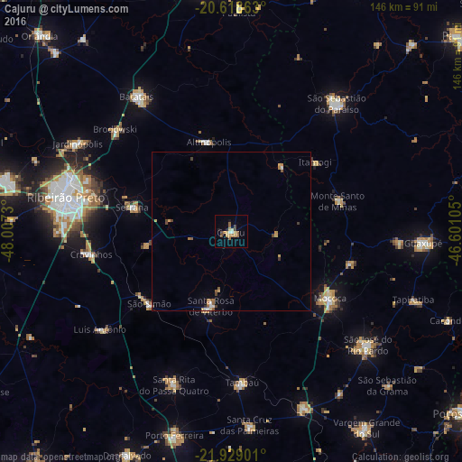
Analysis of Cajuru night lights 2016
Square area 10x10 km:
 0.76%
0.76%90-99
1.52%80-89
1.52%70-79
3.79%60-69
1.7%50-59
3.03%40-49
2.46%30-39
0.38%20-29
1.14%10-19
1.52%0-9
82.2%Square area 50x50 km:
0.14%90-99
0.15%80-89
0.2%70-79
0.32%60-69
0.26%50-59
0.38%40-49
0.3%30-39
0.14%20-29
0.07%10-19
0.11%0-9
97.92%Clear (daylight) street map image can be seen on geolist.org.
Map coordinates:
20° 37' 7.1" South, 48° 0' 26.3" West
21° 16' 31" South, 47° 18' 15" West
21° 55' 44.4" South, 46° 36' 3.8" West
Some cities around Cajuru sort by population:
• Mococa
37.7 km =23.4 mi,  124°
124°
• Serrana
31 km =19.3 mi,  283°
283°
• Cravinhos
44.6 km =27.7 mi,  260°
260°
• Santa Rosa de Viterbo
22.8 km =14.2 mi,  195°
195°
• Tambaú
47.9 km =29.8 mi,  176°
176°
• Monte Santo de Minas
34.9 km =21.7 mi,  74°
74°
• Altinópolis
28.7 km =17.8 mi,  345°
345°
• São Simão
34.1 km =21.2 mi,  228°
228°
3468121 (p: 19,539)
Sources (retrieved 2019-11-25):
» Earth at Night: Flat Maps 2012, 2016