Madan night lights from space
Night Light of Madan (Smolyan) from space (Bulgaria) Src. Average luminocity for 10x10km area is 0.8418% and for 50x50km: 0.9248%.
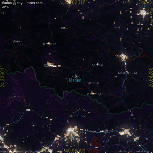
Analysis of Madan night lights 2016
Square area 10x10 km:
 0%
0%90-99
0%80-89
0%70-79
0%60-69
0%50-59
0.68%40-49
0%30-39
0%20-29
1.36%10-19
0%0-9
97.96%Square area 50x50 km:
0.06%90-99
0.17%80-89
0.13%70-79
0.09%60-69
0.1%50-59
0.15%40-49
0.16%30-39
0.11%20-29
0.26%10-19
0.08%0-9
98.69%Clear (daylight) street map image can be seen on geolist.org.
Map coordinates:
42° 1' 23.4" North, 24° 14' 11.8" East
41° 29' 55.3" North, 24° 56' 23" East
40° 58' 11.7" North, 25° 38' 34.3" East
Some cities around Madan sort by population:
• Kardzhali
39.3 km =24.4 mi,  64°
64°
• Xánthi, GR
40.7 km =25.3 mi,  186°
186°
• Komotiní, GR
57.4 km =35.7 mi,  137°
137°
• Smolyan
20.7 km =12.9 mi,  293°
293°
• Devin
52.5 km =32.6 mi,  301°
301°
• Zlatograd
18.6 km =11.6 mi, 135°
• Chepelare
33.7 km =20.9 mi,  320°
320°
• Nedelino
12.6 km =7.8 mi,  112°
112°
729439 (p: 5,661)
Sources (retrieved 2019-11-25):
» Earth at Night: Flat Maps 2012, 2016