Elhovo night lights from space
Night Light of Elhovo (Yambol) from space (Bulgaria) Src. Average luminocity for 10x10km area is 2.397% and for 50x50km: 0.4814%.
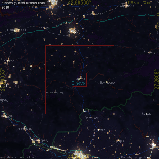
Analysis of Elhovo night lights 2016
Square area 10x10 km:
 0%
0%90-99
0%80-89
0%70-79
0%60-69
0.61%50-59
2.42%40-49
0.61%30-39
0%20-29
0.61%10-19
0%0-9
95.76%Square area 50x50 km:
0.02%90-99
0.01%80-89
0.06%70-79
0.04%60-69
0.05%50-59
0.15%40-49
0.07%30-39
0.28%20-29
0.25%10-19
0.1%0-9
98.97%Clear (daylight) street map image can be seen on geolist.org.
Map coordinates:
42° 41' 8.4" North, 25° 51' 48.8" East
42° 10' 0" North, 26° 34' 0" East
41° 38' 36.1" North, 27° 16' 11.3" East
Some cities around Elhovo sort by population:
• Edirne, TR
54.4 km =33.8 mi,  180°
180°
• Yambol
35.6 km =22.1 mi,  351°
351°
• Svilengrad
53.8 km =33.4 mi,  214°
214°
• Radnevo
54.2 km =33.7 mi,  285°
285°
• Sredets
54.3 km =33.7 mi,  68°
68°
• Lyubimets
54.5 km =33.9 mi,  227°
227°
• Topolovgrad
21.4 km =13.3 mi,  244°
244°
• Straldzha
49.1 km =30.5 mi,  11°
11°
731670 (p: 11,107)
Sources (retrieved 2019-11-25):
» Earth at Night: Flat Maps 2012, 2016