Lyubimets night lights from space
Night Light of Lyubimets (Haskovo) from space (Bulgaria) Src. Average luminocity for 10x10km area is 4.173% and for 50x50km: 1.6883%.
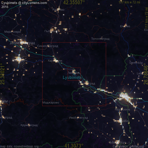
Analysis of Lyubimets night lights 2016
Square area 10x10 km:
 0%
0%90-99
0.63%80-89
0%70-79
0%60-69
0.79%50-59
3.65%40-49
0%30-39
0%20-29
0.95%10-19
1.59%0-9
92.38%Square area 50x50 km:
0.06%90-99
0.25%80-89
0.32%70-79
0.14%60-69
0.21%50-59
0.37%40-49
0.26%30-39
0.28%20-29
0.25%10-19
0.19%0-9
97.68%Clear (daylight) street map image can be seen on geolist.org.
Map coordinates:
42° 21' 18.3" North, 25° 22' 48.8" East
41° 49' 60" North, 26° 4' 60" East
41° 18' 26.3" North, 26° 47' 11.3" East
Some cities around Lyubimets sort by population:
• Edirne, TR
42.9 km =26.7 mi,  113°
113°
• Haskovo
45.1 km =28 mi,  284°
284°
• Dimitrovgrad
46.7 km =29 mi,  301°
301°
• Svilengrad
12.2 km =7.6 mi,  127°
127°
• Harmanli
18.8 km =11.7 mi,  306°
306°
• Gŭlŭbovo
38.5 km =23.9 mi,  329°
329°
• Simeonovgrad
30.4 km =18.9 mi,  317°
317°
• Topolovgrad
34.6 km =21.5 mi,  36°
36°
729466 (p: 8,065)
Sources (retrieved 2019-11-25):
» Earth at Night: Flat Maps 2012, 2016