Bansko night lights from space
Night Light of Bansko (Blagoevgrad) from space (Bulgaria) Src. Average luminocity for 10x10km area is 8.6603% and for 50x50km: 0.9773%.
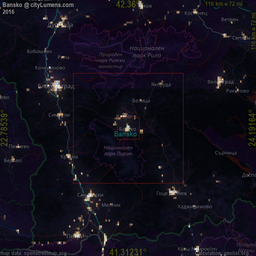
Analysis of Bansko night lights 2016
Square area 10x10 km:
 0%
0%90-99
1.27%80-89
1.27%70-79
1.27%60-69
1.27%50-59
1.9%40-49
1.11%30-39
0.48%20-29
0.32%10-19
1.27%0-9
89.84%Square area 50x50 km:
0.01%90-99
0.12%80-89
0.1%70-79
0.19%60-69
0.13%50-59
0.26%40-49
0.22%30-39
0.12%20-29
0.17%10-19
0.05%0-9
98.63%Clear (daylight) street map image can be seen on geolist.org.
Map coordinates:
42° 21' 36" North, 22° 47' 7.4" East
41° 50' 17.9" North, 23° 29' 18.6" East
41° 18' 44.3" North, 24° 11' 29.9" East
Some cities around Bansko sort by population:
• Blagoevgrad
37.8 km =23.5 mi,  301°
301°
• Sandanski
34.7 km =21.6 mi,  209°
209°
• Velingrad
46.6 km =29 mi,  63°
63°
• Gotse Delchev
36.4 km =22.6 mi,  146°
146°
• Razlog
5.6 km =3.5 mi,  341°
341°
• Simitli
31.2 km =19.4 mi,  279°
279°
• Yakoruda
26.3 km =16.3 mi,  37°
37°
• Pehčevo, MK
50.4 km =31.3 mi,  260°
260°
733462 (p: 9,232)
Sources (retrieved 2019-11-25):
» Earth at Night: Flat Maps 2012, 2016