Meise night lights from space
Night Light of Meise (Flanders) from space (Belgium) Src. Average luminocity for 10x10km area is 74.3515% and for 50x50km: 57.4515%.
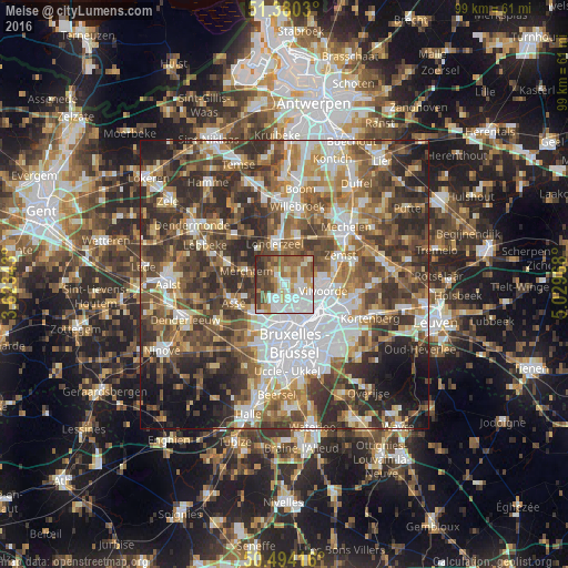
Analysis of Meise night lights 2016
Square area 10x10 km:
 19.19%
90-99
21.29%80-89
6.58%70-79
7.98%60-69
14.01%50-59
11.2%40-49
12.18%30-39
4.34%20-29
3.22%10-19
0%0-9
0%Square area 50x50 km:
12.31%90-99
10.45%80-89
5.82%70-79
6.88%60-69
9.06%50-59
10.77%40-49
11.56%30-39
11.54%20-29
12.43%10-19
6.99%0-9
2.19%Clear (daylight) street map image can be seen on geolist.org.
Map coordinates:
51° 22' 49.1" North, 3° 37' 24.3" East
50° 56' 21.6" North, 4° 19' 35.6" East
50° 29' 39" North, 5° 1' 46.8" East
Some cities around Meise sort by population:
• Vilvoorde
7.3 km =4.5 mi,  99°
99°
• Grimbergen
3.2 km =2 mi, 100°
• Londerzeel
7.4 km =4.6 mi,  347°
347°
• Merchtem
6.8 km =4.2 mi,  281°
281°
• Wemmel
3.8 km =2.4 mi,  202°
202°
• Machelen
8.7 km =5.4 mi,  111°
111°
• Kapelle-op-den-Bos
8.2 km =5.1 mi,  18°
18°
• Diegem
8.8 km =5.5 mi,  121°
121°
2791424 (p: 18,497)
Sources (retrieved 2019-11-25):
» Earth at Night: Flat Maps 2012, 2016