Houthulst night lights from space
Night Light of Houthulst (Flanders) from space (Belgium) Src. Average luminocity for 10x10km area is 10.0762% and for 50x50km: 24.9977%.
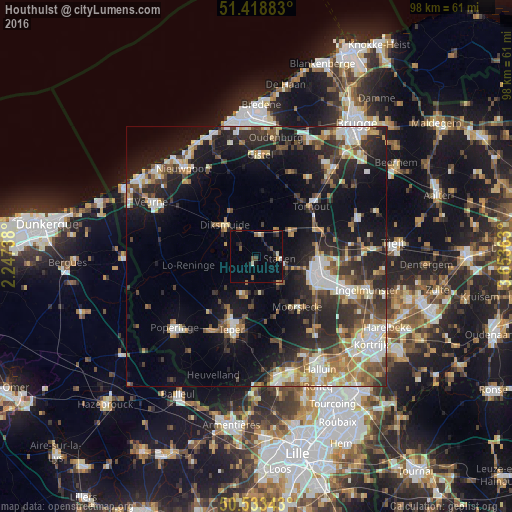
Analysis of Houthulst night lights 2016
Square area 10x10 km:
 0%
0%90-99
1.2%80-89
1.2%70-79
0.53%60-69
1.6%50-59
2.14%40-49
1.47%30-39
1.2%20-29
2.27%10-19
3.34%0-9
85.03%Square area 50x50 km:
3.43%90-99
4.65%80-89
2.77%70-79
2.61%60-69
3.2%50-59
3.61%40-49
3.44%30-39
4.37%20-29
8.35%10-19
16.43%0-9
47.15%Clear (daylight) street map image can be seen on geolist.org.
Map coordinates:
51° 25' 7.8" North, 2° 14' 50.6" East
50° 58' 41.7" North, 2° 57' 1.8" East
50° 32' 0.3" North, 3° 39' 13.1" East
Some cities around Houthulst sort by population:
• Roeselare
12.6 km =7.8 mi,  106°
106°
• Diksmuide
8.6 km =5.3 mi,  314°
314°
• Kortemark
8.5 km =5.3 mi,  48°
48°
• Zonnebeke
12 km =7.5 mi,  167°
167°
• Staden
4.5 km =2.8 mi,  95°
95°
• Moorslede
12.3 km =7.6 mi,  141°
141°
• Hooglede
9.3 km =5.8 mi,  86°
86°
• Koekelare
12.6 km =7.8 mi,  8°
8°
2795255 (p: 8,951)
Sources (retrieved 2019-11-25):
» Earth at Night: Flat Maps 2012, 2016