Velika Obarska night lights from space
Night Light of Velika Obarska (Srpska) from space (Bosnia and Herzegovina) Src. Average luminocity for 10x10km area is 9.9333% and for 50x50km: 2.6155%.
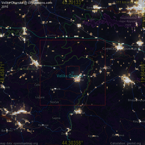
Analysis of Velika Obarska night lights 2016
Square area 10x10 km:
 1.59%
1.59%90-99
2.06%80-89
0.63%70-79
1.27%60-69
0.63%50-59
1.11%40-49
0.79%30-39
0.32%20-29
1.11%10-19
13.02%0-9
77.46%Square area 50x50 km:
0.22%90-99
0.35%80-89
0.16%70-79
0.33%60-69
0.25%50-59
0.71%40-49
0.29%30-39
0.31%20-29
0.58%10-19
1.77%0-9
95.02%Clear (daylight) street map image can be seen on geolist.org.
Map coordinates:
45° 18' 4.8" North, 18° 27' 31.4" East
44° 48' 16.6" North, 19° 9' 42.6" East
44° 18' 12.9" North, 19° 51' 53.9" East
Some cities around Velika Obarska sort by population:
• Šabac, RS
42.2 km =26.2 mi,  98°
98°
• Sremska Mitrovica, RS
40.3 km =25 mi,  61°
61°
• Brčko
28.7 km =17.8 mi,  284°
284°
• Bijeljina
6.6 km =4.1 mi,  140°
140°
• Bogatić, RS
25.4 km =15.8 mi,  81°
81°
• Badovinci, RS
16.7 km =10.4 mi, 97°
• Janja
16.9 km =10.5 mi,  156°
156°
• Gunja, HR
25.7 km =16 mi,  289°
289°
3188199 (p: 5,142)
Sources (retrieved 2019-11-25):
» Earth at Night: Flat Maps 2012, 2016