Šabac night lights from space
Night Light of Šabac (Central Serbia) from space (Serbia) Src. Average luminocity for 10x10km area is 44.9% and for 50x50km: 4.9688%.
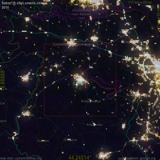
Analysis of Šabac night lights 2016
Square area 10x10 km:
 7.27%
7.27%90-99
12.12%80-89
5.76%70-79
2.73%60-69
5.45%50-59
6.36%40-49
6.97%30-39
3.03%20-29
14.24%10-19
31.82%0-9
4.24%Square area 50x50 km:
0.49%90-99
0.75%80-89
0.35%70-79
0.32%60-69
0.68%50-59
0.82%40-49
0.85%30-39
0.94%20-29
1.52%10-19
3.48%0-9
89.81%Clear (daylight) street map image can be seen on geolist.org.
Map coordinates:
45° 14' 38" North, 18° 59' 12.8" East
44° 44' 48" North, 19° 41' 24" East
44° 14' 42.5" North, 20° 23' 35.3" East
Some cities around Šabac sort by population:
• Sremska Mitrovica
26.3 km =16.3 mi,  346°
346°
• Bijeljina, BA
37.6 km =23.4 mi,  272°
272°
• Ruma
30.9 km =19.2 mi,  19°
19°
• Obrenovac
41.6 km =25.8 mi,  104°
104°
• Bogatić
19.4 km =12.1 mi,  301°
301°
• Badovinci
25.5 km =15.8 mi,  279°
279°
• Janja, BA
36.2 km =22.5 mi,  255°
255°
• Zvečka
39.3 km =24.4 mi,  107°
107°
3191376 (p: 55,114)
Sources (retrieved 2019-11-25):
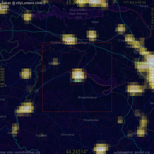
» NASA, Earths city lights 1995
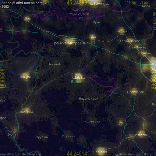
» NASA city lights 2003
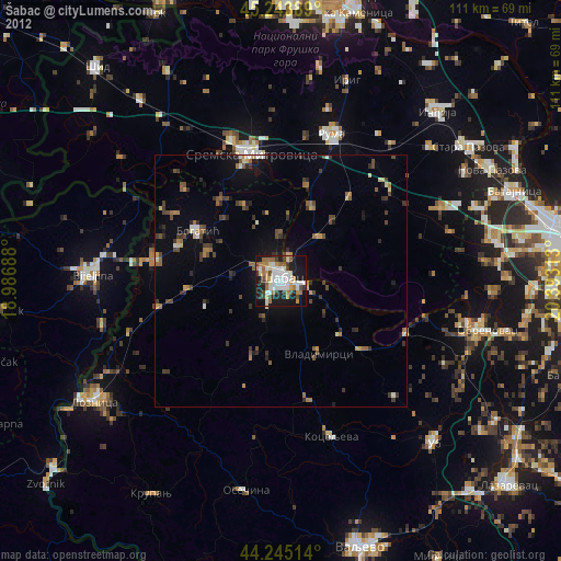
» Earth at Night: Flat Maps 2012, 2016