Rodoč night lights from space
Night Light of Rodoč (Federation of B&H) from space (Bosnia and Herzegovina) Src. Average luminocity for 10x10km area is 45.247% and for 50x50km: 6.0984%.
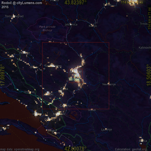
Analysis of Rodoč night lights 2016
Square area 10x10 km:
 7.58%
7.58%90-99
7.88%80-89
5.61%70-79
5.45%60-69
8.18%50-59
9.09%40-49
1.36%30-39
4.09%20-29
20.76%10-19
25.61%0-9
4.39%Square area 50x50 km:
0.46%90-99
0.73%80-89
0.71%70-79
0.66%60-69
1.02%50-59
0.97%40-49
0.86%30-39
0.86%20-29
1.53%10-19
3.58%0-9
88.61%Clear (daylight) street map image can be seen on geolist.org.
Map coordinates:
43° 49' 26.3" North, 17° 5' 59.2" East
43° 18' 52.3" North, 17° 48' 10.4" East
42° 48' 2.8" North, 18° 30' 21.7" East
Some cities around Rodoč sort by population:
• Mostar
3.2 km =2 mi,  7°
7°
• Ljubuški
24.6 km =15.3 mi,  237°
237°
• Široki Brijeg
18.5 km =11.5 mi,  294°
294°
• Potoci
12.2 km =7.6 mi,  30°
30°
• Čapljina
23.5 km =14.6 mi,  204°
204°
• Nevesinje
25.9 km =16.1 mi,  103°
103°
• Crnići
20.9 km =13 mi,  166°
166°
• Čitluk
12.6 km =7.8 mi,  220°
220°
3191589 (p: 5,159)
Sources (retrieved 2019-11-25):
» Earth at Night: Flat Maps 2012, 2016