Čitluk night lights from space
Night Light of Čitluk (Federation of B&H) from space (Bosnia and Herzegovina) Src. Average luminocity for 10x10km area is 12.6545% and for 50x50km: 8.4091%.
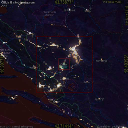
Analysis of Čitluk night lights 2016
Square area 10x10 km:
 0.3%
0.3%90-99
1.97%80-89
1.97%70-79
1.36%60-69
2.42%50-59
1.21%40-49
2.88%30-39
1.52%20-29
1.97%10-19
2.73%0-9
81.67%Square area 50x50 km:
0.61%90-99
1.17%80-89
0.99%70-79
0.91%60-69
1.32%50-59
1.21%40-49
1.13%30-39
1.23%20-29
1.83%10-19
5.06%0-9
84.55%Clear (daylight) street map image can be seen on geolist.org.
Map coordinates:
43° 44' 19.6" North, 16° 59' 51.8" East
43° 13' 43" North, 17° 42' 3" East
42° 42' 50.9" North, 18° 24' 14.3" East
Some cities around Čitluk sort by population:
• Mostar
15.4 km =9.6 mi,  34°
34°
• Metković, HR
19.9 km =12.4 mi,  192°
192°
• Ljubuški
13.1 km =8.1 mi,  254°
254°
• Široki Brijeg
19.2 km =11.9 mi,  333°
333°
• Potoci
24.7 km =15.3 mi,  35°
35°
• Čapljina
12 km =7.5 mi, 186°
• Crnići
17.1 km =10.6 mi,  129°
129°
• Rodoč
12.6 km =7.8 mi, 40°
3202564 (p: 5,718)
Sources (retrieved 2019-11-25):
» Earth at Night: Flat Maps 2012, 2016