Pale night lights from space
Night Light of Pale (Srpska) from space (Bosnia and Herzegovina) Src. Average luminocity for 10x10km area is 8.1015% and for 50x50km: 5.2318%.
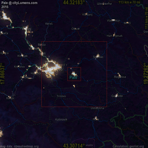
Analysis of Pale night lights 2016
Square area 10x10 km:
 1.36%
1.36%90-99
1.06%80-89
0%70-79
0.61%60-69
1.21%50-59
2.42%40-49
2.42%30-39
0%20-29
1.21%10-19
0%0-9
89.7%Square area 50x50 km:
0.81%90-99
1%80-89
0.47%70-79
0.54%60-69
0.57%50-59
0.65%40-49
0.77%30-39
1.11%20-29
1.53%10-19
3.14%0-9
89.4%Clear (daylight) street map image can be seen on geolist.org.
Map coordinates:
44° 19' 18.6" North, 17° 51' 58.9" East
43° 48' 59.9" North, 18° 34' 10.2" East
43° 18' 25.7" North, 19° 16' 21.4" East
Some cities around Pale sort by population:
• Sarajevo
17.5 km =10.9 mi,  281°
281°
• Visoko
36.7 km =22.8 mi,  301°
301°
• Goražde
36.6 km =22.7 mi,  116°
116°
• Sokolac
22.9 km =14.2 mi,  53°
53°
• Vogošća
20.4 km =12.7 mi, 297°
• Hadžići
29.1 km =18.1 mi,  271°
271°
• Ilijaš
28.2 km =17.5 mi, 302°
• Mahala
33.2 km =20.6 mi,  310°
310°
3193692 (p: 7,458)
Sources (retrieved 2019-11-25):
» Earth at Night: Flat Maps 2012, 2016