Ključ night lights from space
Night Light of Ključ (Federation of B&H) from space (Bosnia and Herzegovina) Src. Average luminocity for 10x10km area is 1.6111% and for 50x50km: 0.3189%.
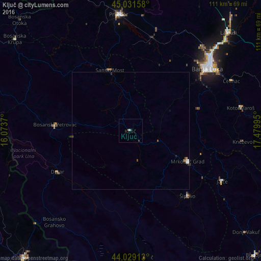
Analysis of Ključ night lights 2016
Square area 10x10 km:
 0%
0%90-99
0.63%80-89
0%70-79
0%60-69
0%50-59
0.63%40-49
0.48%30-39
0.32%20-29
0.48%10-19
0%0-9
97.46%Square area 50x50 km:
0.03%90-99
0.09%80-89
0%70-79
0.02%60-69
0.02%50-59
0.11%40-49
0.05%30-39
0.06%20-29
0.07%10-19
0.02%0-9
99.52%Clear (daylight) street map image can be seen on geolist.org.
Map coordinates:
45° 1' 53.7" North, 16° 4' 25.3" East
44° 31' 57" North, 16° 46' 36.6" East
44° 1' 44.9" North, 17° 28' 47.8" East
Some cities around Ključ sort by population:
• Banja Luka
42.8 km =26.6 mi,  50°
50°
• Mrkonjić Grad
27.5 km =17.1 mi,  117°
117°
• Sanski Most
27.5 km =17.1 mi,  341°
341°
• Šipovo
37.1 km =23.1 mi,  138°
138°
• Jajce
44.6 km =27.7 mi, 118°
• Omarska
41.1 km =25.5 mi,  13°
13°
• Sanica
14.1 km =8.8 mi,  309°
309°
• Mejdan - Obilićevo
41.6 km =25.8 mi, 51°
3198050 (p: 7,245)
Sources (retrieved 2019-11-25):
» Earth at Night: Flat Maps 2012, 2016