Wollongong night lights from space
Night Light of Wollongong (New South Wales) from space (Australia) Src. Average luminocity for 10x10km area is 51.2325% and for 50x50km: 8.007%.
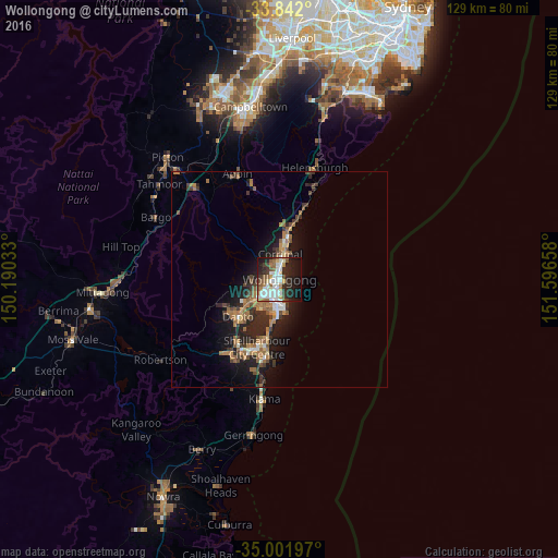

Analysis of Wollongong night lights 2016
Square area 10x10 km:
 11.54%
90-99
15.21%80-89
3.15%70-79
4.72%60-69
5.07%50-59
7.69%40-49
3.85%30-39
5.24%20-29
18.01%10-19
21.68%0-9
3.85%Square area 50x50 km:
0.81%90-99
1.02%80-89
0.39%70-79
0.81%60-69
2.13%50-59
1.4%40-49
1.07%30-39
1.64%20-29
2.9%10-19
5.94%0-9
81.9%Clear (daylight) street map image can be seen on geolist.org.
Map coordinates:
33° 50' 31.2" South, 150° 11' 25.2" East
34° 25' 26.4" South, 150° 53' 36.4" East
35° 0' 7.1" South, 151° 35' 47.7" East
Some cities around Wollongong sort by population:
• Woonona
8.5 km =5.3 mi,  13°
13°
• Figtree
3.5 km =2.2 mi,  248°
248°
• Berkeley
7.7 km =4.8 mi,  211°
211°
• Fairy Meadow
3.4 km =2.1 mi,  358°
358°
• Corrimal
5.1 km =3.2 mi, 10°
• Unanderra
5.3 km =3.3 mi,  232°
232°
• Balgownie
3.4 km =2.1 mi,  339°
339°
• Port Kembla
6.5 km =4 mi,  173°
173°
2171507 (p: 292,190)
Sources (retrieved 2019-11-25):
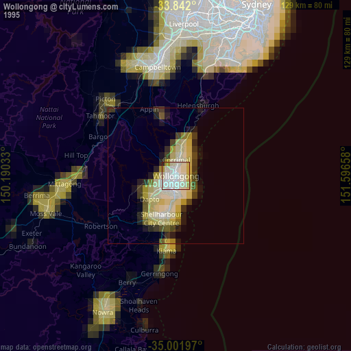
» NASA, Earths city lights 1995
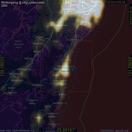
» NASA city lights 2003
» Earth at Night: Flat Maps 2012, 2016