Corrimal night lights from space
Night Light of Corrimal (New South Wales) from space (Australia) Src. Average luminocity for 10x10km area is 35.6026% and for 50x50km: 7.9095%.
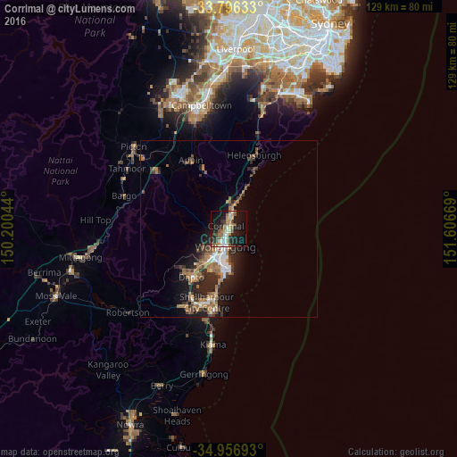
Analysis of Corrimal night lights 2016
Square area 10x10 km:
 3.66%
3.66%90-99
6.41%80-89
3.3%70-79
5.13%60-69
4.95%50-59
7.51%40-49
4.21%30-39
4.76%20-29
10.62%10-19
33.52%0-9
15.93%Square area 50x50 km:
0.82%90-99
1.02%80-89
0.4%70-79
0.83%60-69
2.11%50-59
1.45%40-49
1.04%30-39
1.57%20-29
2.9%10-19
5.39%0-9
82.47%Clear (daylight) street map image can be seen on geolist.org.
Map coordinates:
33° 47' 46.8" South, 150° 12' 1.6" East
34° 22' 43.1" South, 150° 54' 12.8" East
34° 57' 24.9" South, 151° 36' 24.1" East
Some cities around Corrimal sort by population:
• Wollongong
5.1 km =3.2 mi,  190°
190°
• Wollongong city centre
5.6 km =3.5 mi, 190°
• Woonona
3.4 km =2.1 mi,  17°
17°
• Figtree
7.6 km =4.7 mi,  213°
213°
• Fairy Meadow
1.9 km =1.2 mi, 211°
• Bulli
4.6 km =2.9 mi,  11°
11°
• Thirroul
7.2 km =4.5 mi, 13°
• Balgownie
2.8 km =1.7 mi,  229°
229°
2170253 (p: 6,424)
Sources (retrieved 2019-11-25):
» Earth at Night: Flat Maps 2012, 2016