West Lakes night lights from space
Night Light of West Lakes (South Australia) from space (Australia) Src. Average luminocity for 10x10km area is 64.7179% and for 50x50km: 26.8421%.
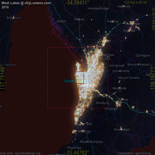
Analysis of West Lakes night lights 2016
Square area 10x10 km:
 17.22%
90-99
20.7%80-89
11.17%70-79
12.27%60-69
2.2%50-59
0.73%40-49
2.2%30-39
2.2%20-29
12.09%10-19
15.75%0-9
3.48%Square area 50x50 km:
5.81%90-99
6.11%80-89
2.8%70-79
4.89%60-69
4.01%50-59
3.42%40-49
2.58%30-39
2.2%20-29
4.68%10-19
8.08%0-9
55.42%Clear (daylight) street map image can be seen on geolist.org.
Map coordinates:
34° 17' 38.8" South, 137° 47' 29.3" East
34° 52' 22.8" South, 138° 29' 40.5" East
35° 26' 52.2" South, 139° 11' 51.8" East
Some cities around West Lakes sort by population:
• Prospect
9.1 km =5.7 mi,  96°
96°
• Seaton
3.6 km =2.2 mi,  146°
146°
• Findon
4.6 km =2.9 mi,  130°
130°
• Fulham Gardens
5 km =3.1 mi,  159°
159°
• Henley Beach
5.3 km =3.3 mi,  180°
180°
• Grange
3.3 km =2.1 mi,  186°
186°
• Lockleys
6.6 km =4.1 mi, 152°
• Kilburn
8.4 km =5.2 mi,  79°
79°
8349013 (p: 5,611)
Sources (retrieved 2019-11-25):
» Earth at Night: Flat Maps 2012, 2016