Kilburn night lights from space
Night Light of Kilburn (South Australia) from space (Australia) Src. Average luminocity for 10x10km area is 93.0549% and for 50x50km: 26.957%.
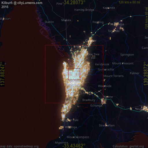
Analysis of Kilburn night lights 2016
Square area 10x10 km:
 41.39%
90-99
40.11%80-89
6.23%70-79
2.56%60-69
2.2%50-59
6.04%40-49
1.47%30-39
0%20-29
0%10-19
0%0-9
0%Square area 50x50 km:
5.8%90-99
6.11%80-89
2.82%70-79
4.83%60-69
3.92%50-59
3.41%40-49
2.58%30-39
2.31%20-29
4.75%10-19
8.48%0-9
54.98%Clear (daylight) street map image can be seen on geolist.org.
Map coordinates:
34° 16' 50.6" South, 137° 52' 56.9" East
34° 51' 34.9" South, 138° 35' 8.1" East
35° 26' 4.6" South, 139° 17' 19.4" East
Some cities around Kilburn sort by population:
• Mawson Lakes
5.3 km =3.3 mi,  22°
22°
• Prospect
2.6 km =1.6 mi,  164°
164°
• Ingle Farm
5.3 km =3.3 mi,  56°
56°
• North Adelaide
5.3 km =3.3 mi,  174°
174°
• Pooraka
5.4 km =3.4 mi,  43°
43°
• Northgate
4 km =2.5 mi,  87°
87°
• Klemzig
5.1 km =3.2 mi,  115°
115°
• Enfield
1.7 km =1.1 mi, 62°
8349138 (p: 5,384)
Sources (retrieved 2019-11-25):
» Earth at Night: Flat Maps 2012, 2016