Warradale night lights from space
Night Light of Warradale (South Australia) from space (Australia) Src. Average luminocity for 10x10km area is 65.2692% and for 50x50km: 24.191%.
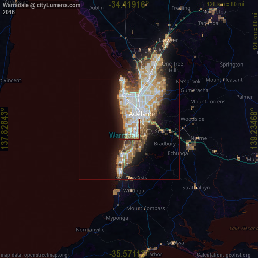
Analysis of Warradale night lights 2016
Square area 10x10 km:
 12.59%
90-99
16.43%80-89
7.69%70-79
15.56%60-69
13.99%50-59
5.77%40-49
2.62%30-39
1.92%20-29
13.64%10-19
9.79%0-9
0%Square area 50x50 km:
5.27%90-99
5.41%80-89
2.31%70-79
4.41%60-69
3.94%50-59
3.3%40-49
2.26%30-39
1.6%20-29
3.91%10-19
7.79%0-9
59.8%Clear (daylight) street map image can be seen on geolist.org.
Map coordinates:
34° 25' 9" South, 137° 49' 42.3" East
34° 59' 49.8" South, 138° 31' 53.6" East
35° 34' 16" South, 139° 14' 4.8" East
Some cities around Warradale sort by population:
• Flagstaff Hill
7.4 km =4.6 mi,  140°
140°
• Sheidow Park
9.1 km =5.7 mi,  182°
182°
• Glenelg North
3.5 km =2.2 mi,  338°
338°
• Henley Beach
9.2 km =5.7 mi, 338°
• Lockleys
7.9 km =4.9 mi,  357°
357°
• Mitchell Park
3.2 km =2 mi,  117°
117°
• Somerton Park
0.9 km =0.6 mi,  270°
270°
• Glengowrie
1.2 km =0.7 mi,  22°
22°
8348474 (p: 5,096)
Sources (retrieved 2019-11-25):
» Earth at Night: Flat Maps 2012, 2016