Mitchell Park night lights from space
Night Light of Mitchell Park (South Australia) from space (Australia) Src. Average luminocity for 10x10km area is 72.0752% and for 50x50km: 23.4154%.
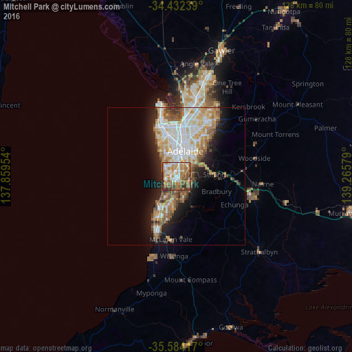
Analysis of Mitchell Park night lights 2016
Square area 10x10 km:
 12.24%
90-99
16.08%80-89
6.47%70-79
17.13%60-69
19.41%50-59
14.69%40-49
8.39%30-39
4.37%20-29
1.22%10-19
0%0-9
0%Square area 50x50 km:
5.13%90-99
5.11%80-89
2.22%70-79
4.26%60-69
3.8%50-59
3.14%40-49
2.29%30-39
1.63%20-29
3.73%10-19
7.76%0-9
60.93%Clear (daylight) street map image can be seen on geolist.org.
Map coordinates:
34° 25' 56.6" South, 137° 51' 34.3" East
35° 0' 37.1" South, 138° 33' 45.6" East
35° 35' 3" South, 139° 15' 56.8" East
Some cities around Mitchell Park sort by population:
• Happy Valley
8.5 km =5.3 mi,  198°
198°
• Aberfoyle Park
7.8 km =4.8 mi,  160°
160°
• Flagstaff Hill
4.6 km =2.9 mi, 156°
• Sheidow Park
8.3 km =5.2 mi, 202°
• Glenelg North
6.3 km =3.9 mi,  318°
318°
• Somerton Park
4 km =2.5 mi,  291°
291°
• Glengowrie
3.5 km =2.2 mi, 317°
• Warradale
3.2 km =2 mi,  297°
297°
8347903 (p: 5,384)
Sources (retrieved 2019-11-25):
» Earth at Night: Flat Maps 2012, 2016