Toormina night lights from space
Night Light of Toormina (New South Wales) from space (Australia) Src. Average luminocity for 10x10km area is 18.1795% and for 50x50km: 1.9476%.
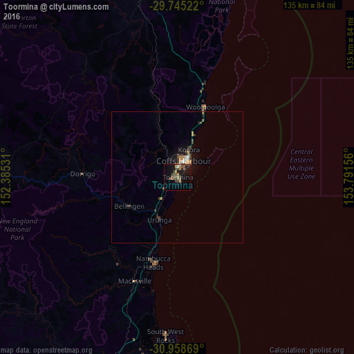
Analysis of Toormina night lights 2016
Square area 10x10 km:
 0.55%
0.55%90-99
0.55%80-89
0%70-79
3.66%60-69
5.13%50-59
3.85%40-49
4.76%30-39
5.49%20-29
2.01%10-19
17.22%0-9
56.78%Square area 50x50 km:
0.1%90-99
0.13%80-89
0.06%70-79
0.42%60-69
0.41%50-59
0.22%40-49
0.45%30-39
0.56%20-29
0.33%10-19
1.53%0-9
95.8%Clear (daylight) street map image can be seen on geolist.org.
Map coordinates:
29° 44' 42.8" South, 152° 23' 7.1" East
30° 21' 13.8" South, 153° 5' 18.3" East
30° 57' 31.3" South, 153° 47' 29.6" East
Some cities around Toormina sort by population:
• Coffs Harbour
6.8 km =4.2 mi,  20°
20°
• Grafton
76.3 km =47.4 mi,  348°
348°
• Kempsey
84.3 km =52.4 mi,  196°
196°
• Nambucca Heads
33.1 km =20.6 mi,  193°
193°
• South Grafton
73.5 km =45.7 mi, 347°
• Nambucca
32.7 km =20.3 mi, 197°
• Woolgoolga
29.1 km =18.1 mi, 21°
• Boambee East
1.7 km =1.1 mi,  298°
298°
7302640 (p: 6,210)
Sources (retrieved 2019-11-25):
» Earth at Night: Flat Maps 2012, 2016