South Perth night lights from space
Night Light of South Perth (Western Australia) from space (Australia) Src. Average luminocity for 10x10km area is 88.1731% and for 50x50km: 42.678%.
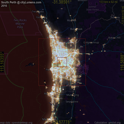
Analysis of South Perth night lights 2016
Square area 10x10 km:
 30.24%
90-99
31.12%80-89
13.81%70-79
12.24%60-69
4.72%50-59
5.07%40-49
2.8%30-39
0%20-29
0%10-19
0%0-9
0%Square area 50x50 km:
9.32%90-99
10.21%80-89
4.98%70-79
6.68%60-69
8.21%50-59
4.8%40-49
3.51%30-39
3.84%20-29
6.97%10-19
8.98%0-9
32.51%Clear (daylight) street map image can be seen on geolist.org.
Map coordinates:
31° 23' 6" South, 115° 9' 48.8" East
31° 58' 60" South, 115° 52' 0" East
32° 34' 40" South, 116° 34' 11.3" East
Some cities around South Perth sort by population:
• Perth
3.5 km =2.2 mi,  351°
351°
• Perth city centre
3.7 km =2.3 mi,  337°
337°
• Como
0.9 km =0.6 mi,  199°
199°
• East Perth
2.8 km =1.7 mi,  8°
8°
• East Victoria Park
3.6 km =2.2 mi,  100°
100°
• Victoria Park
3.7 km =2.3 mi,  77°
77°
• Carlisle
4.9 km =3 mi, 84°
• West Perth
4.5 km =2.8 mi,  328°
328°
2061261 (p: 11,939)
Sources (retrieved 2019-11-25):
» Earth at Night: Flat Maps 2012, 2016