Perth night lights from space
Night Light of Perth (Western Australia) from space (Australia) Src. Average luminocity for 10x10km area is 92.7448% and for 50x50km: 42.8739%.
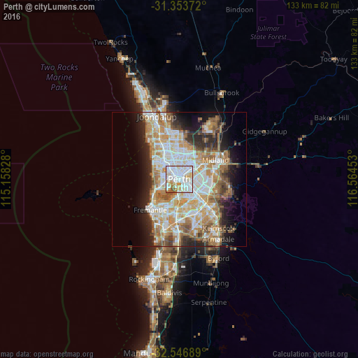
Analysis of Perth night lights 2016
Square area 10x10 km:
 38.64%
90-99
36.89%80-89
10.84%70-79
7.52%60-69
2.62%50-59
3.5%40-49
0%30-39
0%20-29
0%10-19
0%0-9
0%Square area 50x50 km:
9.61%90-99
10.44%80-89
5.01%70-79
6.64%60-69
8.32%50-59
4.84%40-49
3.17%30-39
3.42%20-29
6.61%10-19
8.46%0-9
33.49%Clear (daylight) street map image can be seen on geolist.org.
Map coordinates:
31° 21' 13.4" South, 115° 9' 29.8" East
31° 57' 8.1" South, 115° 51' 41" East
32° 32' 48.8" South, 116° 33' 52.3" East
Fantastic image of Perth from space taken by astronauts [src2], but I don't have information about it's orientation, scale or angle. If necessary, it was rotated manually, so North points approximately to upper direction. Click to zoom in:

Some cities around Perth sort by population:
• Maylands
3.9 km =2.4 mi,  53°
53°
• South Perth
3.5 km =2.2 mi,  171°
171°
• East Perth
1.2 km =0.7 mi,  128°
128°
• Mount Lawley
2.2 km =1.4 mi,  25°
25°
• Subiaco
3.3 km =2.1 mi,  277°
277°
• North Perth
2.9 km =1.8 mi,  343°
343°
• West Perth
1.9 km =1.2 mi, 281°
• Inglewood
4.3 km =2.7 mi,  23°
23°
2063523 (p: 1,896,548)
Sources (retrieved 2019-11-25):
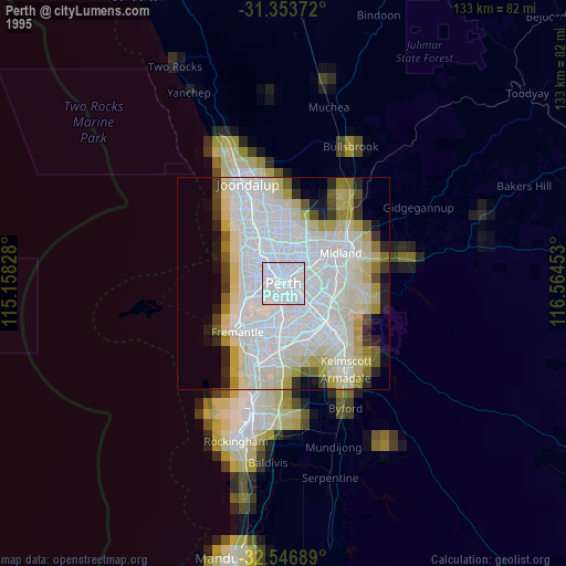
» NASA, Earths city lights 1995
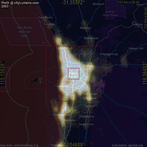
» NASA city lights 2003
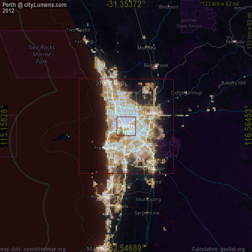
» Earth at Night: Flat Maps 2012, 2016
Src.2: Tim Kopra, Twitter/@astro_tim, 2016-04-17