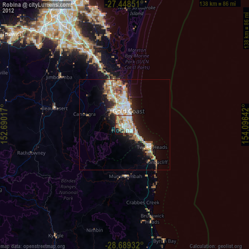
Robina night lights from space
Night Light of Robina (Queensland) from space (Australia) Src. Average luminocity for 10x10km area is 73.8182% and for 50x50km: 15.4607%.
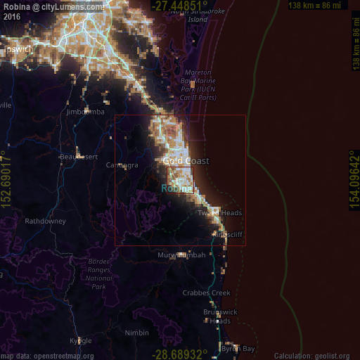
Analysis of Robina night lights 2016
Square area 10x10 km:
 21.21%
90-99
16.86%80-89
9.09%70-79
5.11%60-69
21.02%50-59
8.33%40-49
8.71%30-39
4.36%20-29
2.46%10-19
2.84%0-9
0%Square area 50x50 km:
2.78%90-99
2.96%80-89
1.46%70-79
1.21%60-69
4.28%50-59
1.67%40-49
1.78%30-39
1.79%20-29
3.62%10-19
8.21%0-9
70.24%Clear (daylight) street map image can be seen on geolist.org.
Map coordinates:
27° 26' 54.6" South, 152° 41' 24.6" East
28° 4' 14.6" South, 153° 23' 35.8" East
28° 41' 21.6" South, 154° 5' 47.1" East
Some cities around Robina sort by population:
• Varsity Lakes
2.8 km =1.7 mi,  138°
138°
• Burleigh Waters
4.5 km =2.8 mi, 136°
• Mudgeeraba
3 km =1.9 mi,  241°
241°
• Mermaid Waters
4.4 km =2.7 mi,  56°
56°
• Miami
4.7 km =2.9 mi,  91°
91°
• Merrimac
3 km =1.9 mi,  318°
318°
• Reedy Creek
4.6 km =2.9 mi,  176°
176°
• Worongary
4.8 km =3 mi,  298°
298°
8348930 (p: 23,140)
Sources (retrieved 2019-11-25):
» Earth at Night: Flat Maps 2012, 2016