Miami night lights from space
Night Light of Miami (Queensland) from space (Australia) Src. Average luminocity for 10x10km area is 60.0398% and for 50x50km: 15.3711%.
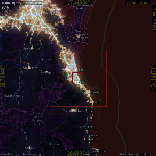
Analysis of Miami night lights 2016
Square area 10x10 km:
 19.32%
90-99
14.77%80-89
7.39%70-79
2.46%60-69
11.74%50-59
1.52%40-49
4.17%30-39
4.55%20-29
17.05%10-19
13.07%0-9
3.98%Square area 50x50 km:
2.78%90-99
2.96%80-89
1.46%70-79
1.21%60-69
4.22%50-59
1.67%40-49
1.74%30-39
1.72%20-29
3.62%10-19
8.21%0-9
70.42%Clear (daylight) street map image can be seen on geolist.org.
Map coordinates:
27° 26' 58.3" South, 152° 44' 18.5" East
28° 4' 18.2" South, 153° 26' 29.7" East
28° 41' 25.2" South, 154° 8' 41" East
Some cities around Miami sort by population:
• Robina
4.7 km =2.9 mi,  271°
271°
• Varsity Lakes
3.5 km =2.2 mi,  235°
235°
• Burleigh Waters
3.5 km =2.2 mi,  208°
208°
• Mermaid Waters
2.7 km =1.7 mi,  337°
337°
• Burleigh Heads
3.3 km =2.1 mi,  165°
165°
• Broadbeach
4.9 km =3 mi,  350°
350°
• Broadbeach Waters
4.4 km =2.7 mi, 338°
• Mermaid Beach
3.1 km =1.9 mi, 347°
7932257 (p: 7,162)
Sources (retrieved 2019-11-25):
» Earth at Night: Flat Maps 2012, 2016