Raby night lights from space
Night Light of Raby (New South Wales) from space (Australia) Src. Average luminocity for 10x10km area is 62.0087% and for 50x50km: 29.7714%.
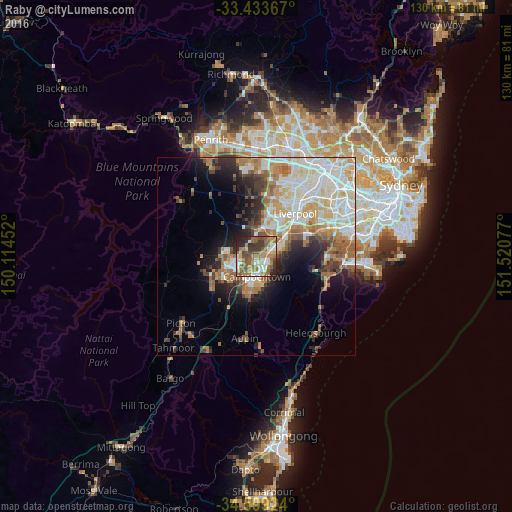
Analysis of Raby night lights 2016
Square area 10x10 km:
 9.62%
9.62%90-99
8.22%80-89
6.99%70-79
8.22%60-69
20.45%50-59
17.13%40-49
9.27%30-39
9.79%20-29
8.92%10-19
1.4%0-9
0%Square area 50x50 km:
6.51%90-99
7.08%80-89
3.58%70-79
3.71%60-69
5.31%50-59
3.63%40-49
2.58%30-39
3.7%20-29
4.39%10-19
7.09%0-9
52.44%Clear (daylight) street map image can be seen on geolist.org.
Map coordinates:
33° 26' 1.2" South, 150° 6' 52.3" East
34° 1' 6.5" South, 150° 49' 3.5" East
34° 35' 57.3" South, 151° 31' 14.8" East
Some cities around Raby sort by population:
• Ingleburn
5 km =3.1 mi,  65°
65°
• Campbelltown
5.4 km =3.4 mi,  180°
180°
• Minto
3.4 km =2.1 mi,  119°
119°
• Leumeah
3.8 km =2.4 mi,  157°
157°
• Eagle Vale
2.1 km =1.3 mi,  189°
189°
• St Andrews
1.2 km =0.7 mi,  111°
111°
• Ruse
6.1 km =3.8 mi, 158°
• Currans Hill
4.9 km =3 mi,  236°
236°
8348167 (p: 5,885)
Sources (retrieved 2019-11-25):
» Earth at Night: Flat Maps 2012, 2016