Leumeah night lights from space
Night Light of Leumeah (New South Wales) from space (Australia) Src. Average luminocity for 10x10km area is 57.9126% and for 50x50km: 26.8509%.
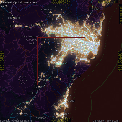
Analysis of Leumeah night lights 2016
Square area 10x10 km:
 8.92%
8.92%90-99
9.09%80-89
6.82%70-79
8.74%60-69
18.01%50-59
13.46%40-49
8.74%30-39
4.02%20-29
8.74%10-19
10.31%0-9
3.15%Square area 50x50 km:
5.43%90-99
6.24%80-89
3.4%70-79
3.28%60-69
4.86%50-59
3.55%40-49
2.5%30-39
3.56%20-29
3.93%10-19
6.67%0-9
56.57%Clear (daylight) street map image can be seen on geolist.org.
Map coordinates:
33° 27' 55.5" South, 150° 7' 48.8" East
34° 3' 0" South, 150° 49' 60" East
34° 37' 50.1" South, 151° 32' 11.3" East
Some cities around Leumeah sort by population:
• Campbelltown
2.4 km =1.5 mi,  219°
219°
• Minto
2.4 km =1.5 mi,  39°
39°
• Bradbury
4.3 km =2.7 mi,  202°
202°
• Ambarvale
5.5 km =3.4 mi, 217°
• Raby
3.8 km =2.4 mi,  337°
337°
• Eagle Vale
2.3 km =1.4 mi,  307°
307°
• St Andrews
3.1 km =1.9 mi,  353°
353°
• Ruse
2.3 km =1.4 mi,  160°
160°
2160299 (p: 9,767)
Sources (retrieved 2019-11-25):
» Earth at Night: Flat Maps 2012, 2016