Oxley night lights from space
Night Light of Oxley (Queensland) from space (Australia) Src. Average luminocity for 10x10km area is 87.4504% and for 50x50km: 44.9786%.
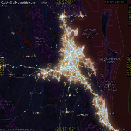
Analysis of Oxley night lights 2016
Square area 10x10 km:
 24.8%
24.8%90-99
26.98%80-89
13.89%70-79
24.4%60-69
9.52%50-59
0.4%40-49
0%30-39
0%20-29
0%10-19
0%0-9
0%Square area 50x50 km:
8.85%90-99
9.61%80-89
5.57%70-79
6.37%60-69
11.95%50-59
3.88%40-49
4.7%30-39
4.36%20-29
7.8%10-19
10.27%0-9
26.65%Clear (daylight) street map image can be seen on geolist.org.
Map coordinates:
26° 55' 29.4" South, 152° 16' 48.8" East
27° 33' 0" South, 152° 58' 60" East
28° 10' 17.8" South, 153° 41' 11.3" East
Some cities around Oxley sort by population:
• Inala
5.3 km =3.3 mi,  189°
189°
• Indooroopilly
5.3 km =3.3 mi,  351°
351°
• Moorooka
4.4 km =2.7 mi,  66°
66°
• Durack
4.4 km =2.7 mi,  176°
176°
• Yeronga
5 km =3.1 mi,  40°
40°
• Sinnamon Park
3.5 km =2.2 mi,  280°
280°
• Salisbury
4.8 km =3 mi,  91°
91°
• Jindalee
4.8 km =3 mi,  291°
291°
2154050 (p: 8,344)
Sources (retrieved 2019-11-25):
» Earth at Night: Flat Maps 2012, 2016