Yeronga night lights from space
Night Light of Yeronga (Queensland) from space (Australia) Src. Average luminocity for 10x10km area is 91.0456% and for 50x50km: 46.1639%.
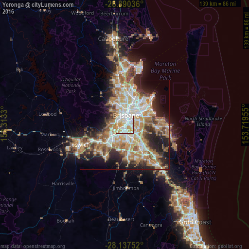
Analysis of Yeronga night lights 2016
Square area 10x10 km:
 28.97%
90-99
33.93%80-89
15.87%70-79
18.45%60-69
2.78%50-59
0%40-49
0%30-39
0%20-29
0%10-19
0%0-9
0%Square area 50x50 km:
8.86%90-99
9.63%80-89
5.74%70-79
6.62%60-69
12.52%50-59
4.03%40-49
4.82%30-39
4.84%20-29
8.33%10-19
10.84%0-9
23.77%Clear (daylight) street map image can be seen on geolist.org.
Map coordinates:
26° 53' 25.3" South, 152° 18' 47.9" East
27° 30' 56.6" South, 153° 0' 59.1" East
28° 8' 15.1" South, 153° 43' 10.4" East
Some cities around Yeronga sort by population:
• Annerley
1.6 km =1 mi,  76°
76°
• Tarragindi
3.1 km =1.9 mi,  113°
113°
• Moorooka
2.2 km =1.4 mi,  158°
158°
• West End
4.1 km =2.5 mi,  350°
350°
• Greenslopes
3.4 km =2.1 mi, 75°
• South Brisbane
4 km =2.5 mi,  5°
5°
• Woolloongabba
3.6 km =2.2 mi,  33°
33°
• Highgate Hill
3 km =1.9 mi,  4°
4°
9957353 (p: 6,364)
Sources (retrieved 2019-11-25):
» Earth at Night: Flat Maps 2012, 2016