Nuriootpa night lights from space
Night Light of Nuriootpa (South Australia) from space (Australia) Src. Average luminocity for 10x10km area is 13.8462% and for 50x50km: 1.8886%.
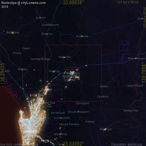
Analysis of Nuriootpa night lights 2016
Square area 10x10 km:
 0%
0%90-99
0%80-89
0%70-79
2.45%60-69
4.2%50-59
5.59%40-49
3.85%30-39
3.85%20-29
0.87%10-19
1.57%0-9
77.62%Square area 50x50 km:
0.03%90-99
0.06%80-89
0.06%70-79
0.32%60-69
0.58%50-59
0.55%40-49
0.34%30-39
0.52%20-29
0.19%10-19
1.05%0-9
96.31%Clear (daylight) street map image can be seen on geolist.org.
Map coordinates:
33° 53' 11.6" South, 138° 17' 40.4" East
34° 28' 5.7" South, 138° 59' 51.6" East
35° 2' 45.3" South, 139° 42' 2.9" East
Some cities around Nuriootpa sort by population:
• Gawler
27.2 km =16.9 mi,  236°
236°
• Craigmore
36.9 km =22.9 mi,  225°
225°
• Andrews Farm
38.5 km =23.9 mi, 233°
• Blakeview
35 km =21.7 mi, 228°
• Davoren Park
39 km =24.2 mi, 230°
• Munno Para West
36.3 km =22.6 mi, 233°
• Gawler East
25.9 km =16.1 mi, 235°
• Elizabeth Downs
38.1 km =23.7 mi, 227°
2064340 (p: 6,213)
Sources (retrieved 2019-11-25):
» Earth at Night: Flat Maps 2012, 2016