Greystanes night lights from space
Night Light of Greystanes (New South Wales) from space (Australia) Src. Average luminocity for 10x10km area is 93.8147% and for 50x50km: 55.9418%.
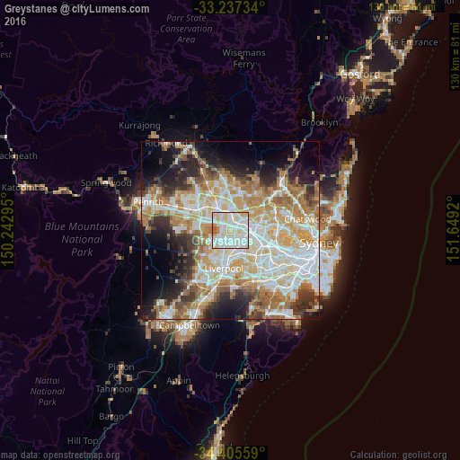
Analysis of Greystanes night lights 2016
Square area 10x10 km:
 35.66%
90-99
40.21%80-89
16.61%70-79
4.37%60-69
1.75%50-59
1.4%40-49
0%30-39
0%20-29
0%10-19
0%0-9
0%Square area 50x50 km:
12.88%90-99
13.86%80-89
7.62%70-79
9.16%60-69
10.01%50-59
5.12%40-49
3.9%30-39
5.54%20-29
7.09%10-19
9.2%0-9
15.63%Clear (daylight) street map image can be seen on geolist.org.
Map coordinates:
33° 14' 14.4" South, 150° 14' 34.6" East
33° 49' 24.5" South, 150° 56' 45.9" East
34° 24' 20.1" South, 151° 38' 57.1" East
Some cities around Greystanes sort by population:
• Merrylands
3.6 km =2.2 mi,  107°
107°
• Westmead
4.4 km =2.7 mi,  60°
60°
• Smithfield
3.2 km =2 mi,  201°
201°
• Wentworthville
2.8 km =1.7 mi,  46°
46°
• Pendle Hill
2.3 km =1.4 mi,  21°
21°
• Merrylands West
2.4 km =1.5 mi,  115°
115°
• South Wentworthville
1.7 km =1.1 mi,  71°
71°
• Girraween
2.7 km =1.7 mi,  354°
354°
8348582 (p: 22,591)
Sources (retrieved 2019-11-25):
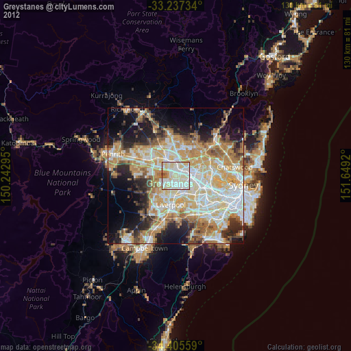
» Earth at Night: Flat Maps 2012, 2016