Maryborough night lights from space
Night Light of Maryborough (Victoria) from space (Australia) Src. Average luminocity for 10x10km area is 6.017% and for 50x50km: 0.2666%.
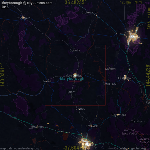
Analysis of Maryborough night lights 2016
Square area 10x10 km:
 0.34%
0.34%90-99
0.34%80-89
0%70-79
3.4%60-69
1.19%50-59
1.02%40-49
1.19%30-39
0%20-29
0%10-19
0%0-9
92.52%Square area 50x50 km:
0.01%90-99
0.01%80-89
0%70-79
0.14%60-69
0.05%50-59
0.04%40-49
0.05%30-39
0.04%20-29
0.01%10-19
0%0-9
99.64%Clear (daylight) street map image can be seen on geolist.org.
Map coordinates:
36° 28' 56.5" South, 143° 2' 10" East
37° 2' 44.2" South, 143° 44' 21.2" East
37° 36' 17.1" South, 144° 26' 32.5" East
Some cities around Maryborough sort by population:
• Bendigo
57.8 km =35.9 mi,  56°
56°
• Wendouree
54.5 km =33.9 mi,  171°
171°
• Kangaroo Flat
53 km =32.9 mi, 58°
• Alfredton
58.3 km =36.2 mi, 173°
• Golden Square
54.8 km =34.1 mi, 56°
• Castlemaine
42.4 km =26.3 mi,  93°
93°
• Bendigo city centre
57.8 km =35.9 mi, 56°
• Ballarat Central
58.3 km =36.2 mi, 170°
2158561 (p: 7,830)
Sources (retrieved 2019-11-25):
» Earth at Night: Flat Maps 2012, 2016