Logan City night lights from space
Night Light of Logan City (Queensland) from space (Australia) Src. Average luminocity for 10x10km area is 77.8829% and for 50x50km: 38.7015%.
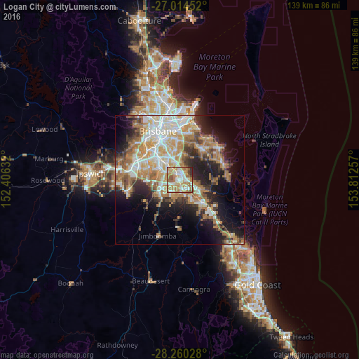
Analysis of Logan City night lights 2016
Square area 10x10 km:
 15.87%
90-99
18.06%80-89
13.1%70-79
17.46%60-69
22.22%50-59
6.75%40-49
3.17%30-39
1.79%20-29
1.59%10-19
0%0-9
0%Square area 50x50 km:
7.01%90-99
7.79%80-89
4.37%70-79
5.44%60-69
10.95%50-59
3.54%40-49
3.85%30-39
4.28%20-29
6.99%10-19
12.22%0-9
33.56%Clear (daylight) street map image can be seen on geolist.org.
Map coordinates:
27° 0' 52.3" South, 152° 24' 22.8" East
27° 38' 21" South, 153° 6' 34" East
28° 15' 37" South, 153° 48' 45.3" East
Some cities around Logan City sort by population:
• Marsden
4 km =2.5 mi,  197°
197°
• Woodridge
1.1 km =0.7 mi,  304°
304°
• Kingston
3.1 km =1.9 mi,  166°
166°
• Slacks Creek
4.2 km =2.6 mi,  106°
106°
• Springwood
3.6 km =2.2 mi,  32°
32°
• Kuraby
3.9 km =2.4 mi,  336°
336°
• Daisy Hill
4.9 km =3 mi,  78°
78°
• Underwood
3.4 km =2.1 mi,  3°
3°
7281838 (p: 282,673)
Sources (retrieved 2019-11-25):
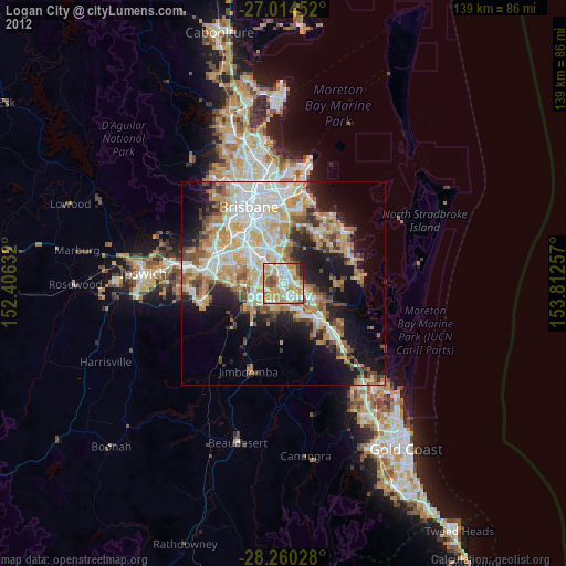
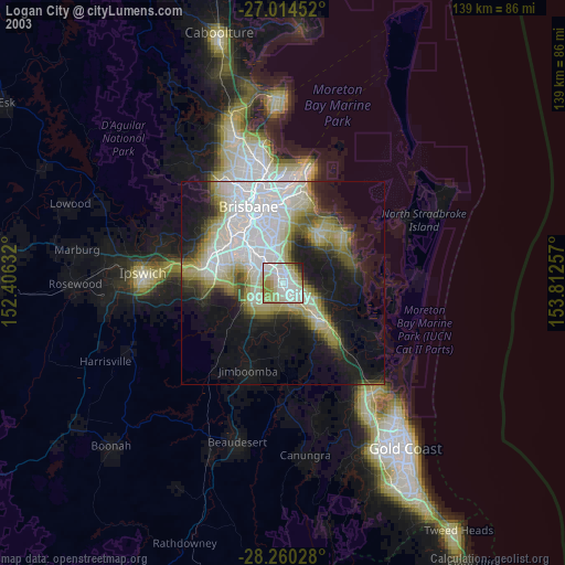
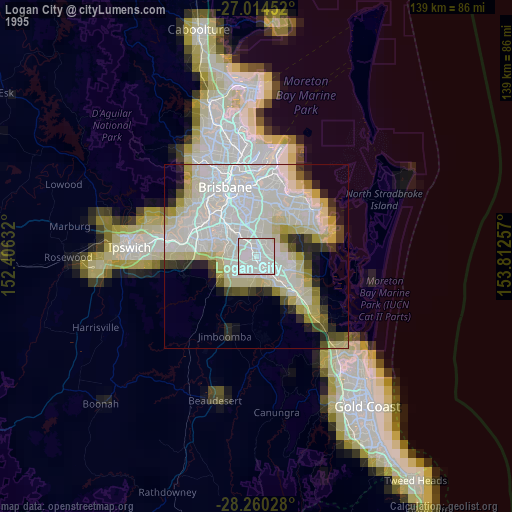
» NASA, Earths city lights 1995
» NASA city lights 2003
» Earth at Night: Flat Maps 2012, 2016