Leongatha night lights from space
Night Light of Leongatha (Victoria) from space (Australia) Src. Average luminocity for 10x10km area is 3.849% and for 50x50km: 0.3903%.
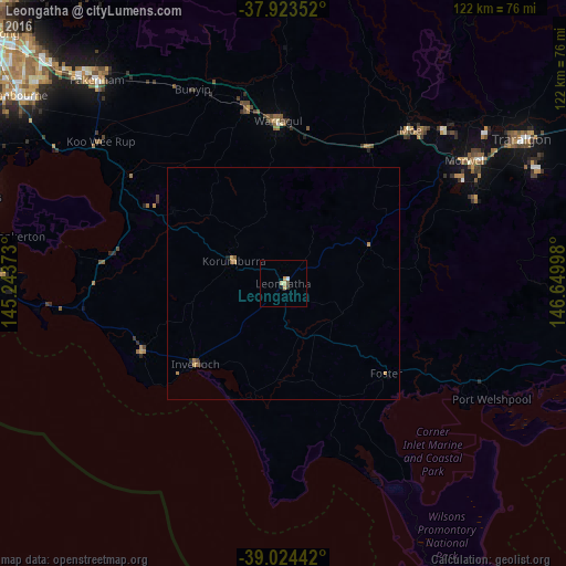
Analysis of Leongatha night lights 2016
Square area 10x10 km:
 0.32%
0.32%90-99
0.49%80-89
1.14%70-79
1.3%60-69
0%50-59
0%40-49
0.65%30-39
0.49%20-29
0.16%10-19
0.65%0-9
94.81%Square area 50x50 km:
0.01%90-99
0.02%80-89
0.05%70-79
0.19%60-69
0.06%50-59
0.07%40-49
0.05%30-39
0.03%20-29
0.05%10-19
0.05%0-9
99.41%Clear (daylight) street map image can be seen on geolist.org.
Map coordinates:
37° 55' 24.7" South, 145° 14' 37.4" East
38° 28' 33.9" South, 145° 56' 48.7" East
39° 1' 27.9" South, 146° 38' 59.9" East
Some cities around Leongatha sort by population:
• Pakenham
61.2 km =38 mi,  317°
317°
• Traralgon
60.5 km =37.6 mi,  58°
58°
• Warragul
35.3 km =21.9 mi,  357°
357°
• Morwell
47.4 km =29.5 mi, 55°
• Drouin
38.5 km =23.9 mi,  348°
348°
• Moe
43 km =26.7 mi,  39°
39°
• Newborough
45.3 km =28.1 mi, 41°
• Inverloch
25.7 km =16 mi,  229°
229°
2160339 (p: 5,408)
Sources (retrieved 2019-11-25):
» Earth at Night: Flat Maps 2012, 2016