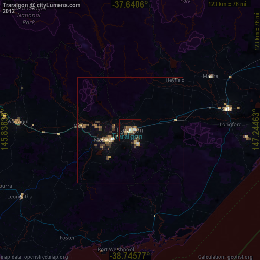
Traralgon night lights from space
Night Light of Traralgon (Victoria) from space (Australia) Src. Average luminocity for 10x10km area is 21.2024% and for 50x50km: 3.0346%.
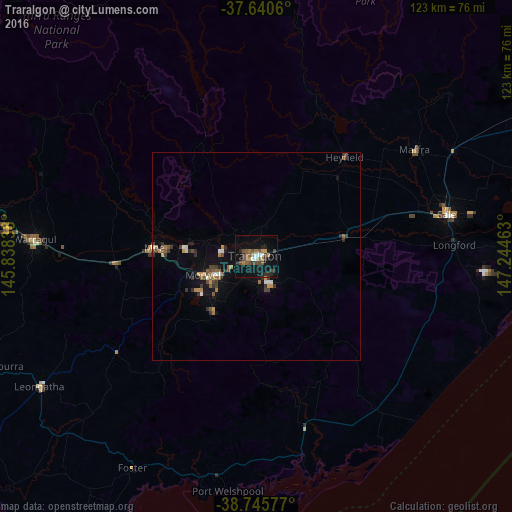
Analysis of Traralgon night lights 2016
Square area 10x10 km:
 1.19%
1.19%90-99
2.21%80-89
0%70-79
3.74%60-69
3.06%50-59
4.25%40-49
6.12%30-39
2.38%20-29
6.8%10-19
23.81%0-9
46.43%Square area 50x50 km:
0.2%90-99
0.31%80-89
0.03%70-79
0.48%60-69
0.46%50-59
0.6%40-49
0.53%30-39
0.77%20-29
0.7%10-19
2.21%0-9
93.7%Clear (daylight) street map image can be seen on geolist.org.
Map coordinates:
37° 38' 26.2" South, 145° 50' 18.2" East
38° 11' 43" South, 146° 32' 29.4" East
38° 44' 44.8" South, 147° 14' 40.7" East
Some cities around Traralgon sort by population:
• Warragul
53.5 km =33.2 mi,  274°
274°
• Morwell
13.5 km =8.4 mi,  251°
251°
• Sale
47 km =29.2 mi,  78°
78°
• Drouin
60.1 km =37.3 mi,  276°
276°
• Moe
24.6 km =15.3 mi, 274°
• Newborough
21.9 km =13.6 mi, 276°
• Leongatha
60.5 km =37.6 mi,  238°
238°
• Maffra
46 km =28.6 mi,  57°
57°
2146108 (p: 24,605)
Sources (retrieved 2019-11-25):
» Earth at Night: Flat Maps 2012, 2016