Kiama night lights from space
Night Light of Kiama (New South Wales) from space (Australia) Src. Average luminocity for 10x10km area is 10.1976% and for 50x50km: 5.9949%.
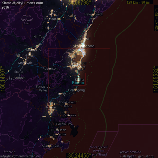
Analysis of Kiama night lights 2016
Square area 10x10 km:
 0%
0%90-99
2.1%80-89
0%70-79
0.52%60-69
2.45%50-59
1.22%40-49
0.7%30-39
4.2%20-29
2.1%10-19
5.24%0-9
81.47%Square area 50x50 km:
0.58%90-99
0.71%80-89
0.26%70-79
0.6%60-69
1.91%50-59
1.14%40-49
0.68%30-39
1.07%20-29
2.22%10-19
4.03%0-9
86.79%Clear (daylight) street map image can be seen on geolist.org.
Map coordinates:
34° 5' 16.7" South, 150° 8' 56.7" East
34° 40' 5.8" South, 150° 51' 7.9" East
35° 14' 40.4" South, 151° 33' 19.2" East
Some cities around Kiama sort by population:
• Albion Park
12.9 km =8 mi,  327°
327°
• Dapto
19 km =11.8 mi,  343°
343°
• Albion Park Rail
12.6 km =7.8 mi, 333°
• Flinders
9.4 km =5.8 mi,  1°
1°
• Oak Flats
12.1 km =7.5 mi,  346°
346°
• Warilla
13 km =8.1 mi, 2°
• Barrack Heights
11.5 km =7.1 mi, 2°
• Shell Cove
8.8 km =5.5 mi,  5°
5°
2161515 (p: 6,836)
Sources (retrieved 2019-11-25):
» Earth at Night: Flat Maps 2012, 2016