Katoomba night lights from space
Night Light of Katoomba (New South Wales) from space (Australia) Src. Average luminocity for 10x10km area is 9.6447% and for 50x50km: 1.2342%.
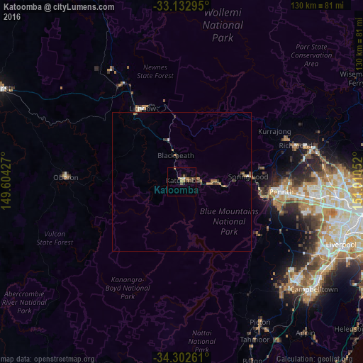
Analysis of Katoomba night lights 2016
Square area 10x10 km:
 0.37%
0.37%90-99
0.92%80-89
0.18%70-79
1.83%60-69
2.56%50-59
1.83%40-49
2.38%30-39
1.83%20-29
1.47%10-19
0.92%0-9
85.71%Square area 50x50 km:
0.05%90-99
0.07%80-89
0.04%70-79
0.26%60-69
0.39%50-59
0.13%40-49
0.27%30-39
0.39%20-29
0.14%10-19
0.05%0-9
98.22%Clear (daylight) street map image can be seen on geolist.org.
Map coordinates:
33° 7' 58.6" South, 149° 36' 15.4" East
33° 43' 11.2" South, 150° 18' 26.6" East
34° 18' 9.4" South, 151° 0' 37.9" East
Some cities around Katoomba sort by population:
• Glenmore Park
34.4 km =21.4 mi,  103°
103°
• Emu Plains
33.4 km =20.8 mi, 95°
• Springwood
22.5 km =14 mi,  84°
84°
• Blaxland
27.3 km =17 mi, 97°
• Winmalee
28.6 km =17.8 mi, 80°
• Wentworth Falls
6.4 km =4 mi, 80°
• Jamisontown
34.6 km =21.5 mi, 98°
• Lithgow
30 km =18.6 mi,  330°
330°
2161776 (p: 8,204)
Sources (retrieved 2019-11-25):
» Earth at Night: Flat Maps 2012, 2016